BioDiversity Legacy (BDL) is engaging with a growing number of landholders on the Far South Coast of New South Wales who are interested in exploring how BDL’s land protection pathways can not only safeguard individual properties but help communities connect their landscapes and expand their conservation ambitions.
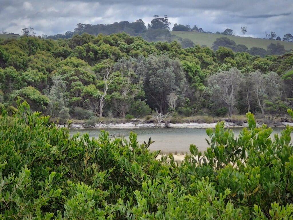
In October, BDL Communities & Stewardship Manager, Robyn Edwards, visited a remarkable 27-ha property adjoining Tilba Tilba Lake in the Gulaga/Eurobodalla region that has been lovingly restored over the past 45 years by members of the Tilba Lake Community (TLC).
The property, once cleared and degraded, has been transformed into a thriving haven for biodiversity, with over 200 bird species recorded, a healthy Diamond Python population, returning Long-nosed Bandicoots and nationally endangered species, including the Glossy Black-Cockatoo and Hooded Plover.
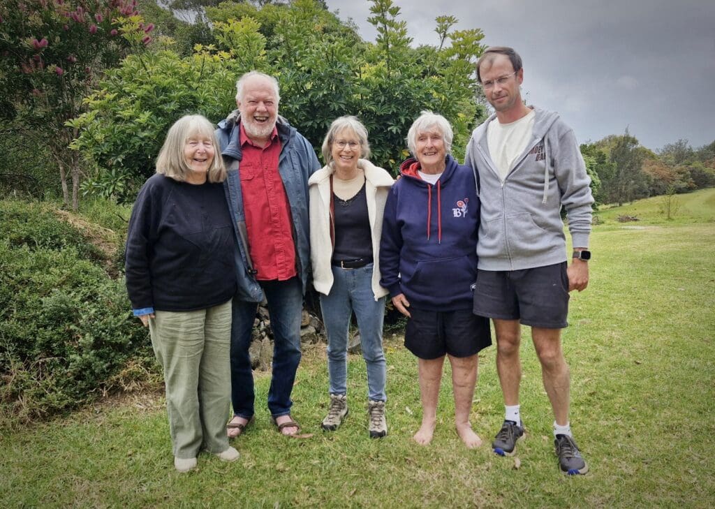
During the visit, Robyn joined Local Land Services NSW and TLC members Geoff Pryor, Noel Pratt, Dr Liz Dennis and her son, Dr Clancy Dennis, in a wide-ranging conversation about the property’s natural and cultural values, land transition pathways and the Biosphere Region proposal originally developed by the Tilba Environment Landcare Group as part of the Tilba Chamber of Commerce strategy review in the wake of the 2019–20 bushfires.
“A big part of our role at BioDiversity Legacy is guiding communities through a progression – from connection and learning to agency, active hope and, ultimately, positive, lasting conservation pathways,” says Robyn.
“It was inspiring to meet the landholders, learn about the Yuin people’s connection to Country and see how the Tilba property has been brought back to life. We’ll do what we can to support this group and the wider community to pursue their landscape vision.”
Photo right: Shareholders of the Tilba Lake Community Pty Ltd property enjoyed conversations with BioDiversity Legacy’s Robyn Edwards. Left to right: Noel and Geoff Pryor, Robyn Edwards, Liz Dennis and son Clancy.
At Biodiversity Legacy, we believe that real, lasting change happens when passionate people and organisations come together with a shared purpose. That’s why we’re proud to be part of the Ecolands Collective – a growing alliance of emerging and regional conservation groups working collaboratively to strengthen biolinks, support threatened species and drive some of the high-impact environmental projects highlighted below.
Partnering for Quoll Recovery in East Gippsland
One standout initiative is a bold Spot-tailed Quoll recovery project in East Gippsland, led by colleagues at the Bairnsdale-based ecological not-for-profit, Wildlife Unlimited (WUL).
This 10-year program, supported by the Victorian Government’s Nature Fund (2024), aims to rebuild local populations of this elusive apex predator, whose numbers have plummeted dramatically in recent decades. The project brings together a powerful consortium of experts, including ecologists, geneticists, First Nations communities, species reintroduction specialists and concerned government and non-government organisations.
The epicentre of this activity is the rugged Little River Gorge – a remote and vital stronghold for the species in East Gippsland. Here, field ecologists trek deep into the bush to monitor populations, explore reintroduction options and advocate for landscape-scale recovery efforts.
Importantly, quoll conservation has broader ecological benefits, with recovery actions expected to support 17 nationally listed and over 150 state-listed threatened species – including the Brush-tailed Rock-wallaby, Southern Brown Bandicoot, Southern Greater Glider, Glossy Black-Cockatoo, and Powerful Owl [to find out more, or to donate to the Quoll Recovery Project »].
Restoring Sheoak for Glossy Black-Cockatoos
Still in East Gippsland – a region continuing to recover from the 2019/20 bushfires – Biodiversity Legacy is supporting the Helping Hands for Sheoak project, which is restoring feeding habitat for the endangered Glossy Black-Cockatoo, which feeds almost exclusively on Sheoak seeds.
This collaborative effort builds upon previous work carried out by DEECA and Birdlife Australia and includes participation by Wildlife Unlimited, Biodiversity Legacy, Far East Victoria Landcare, Moogji Aboriginal Council and Friends of Mallacoota. By supporting landholders, this project delivers both ecological restoration and community empowerment, contributing to species recovery across a fragmented landscape [learn more about Helping Hands for Sheoak »].
Nature Recovery Along the Bass Coast
On Victoria’s Bass Coast, just 14% of native vegetation remains, but a bold new initiative is turning the tide. The Nature Recovery Foundation (NRF), co-founded by Bass Coast Shire and Biodiversity Legacy, is working with landholders and the wider community to halt biodiversity loss and strengthen wildlife corridors. This whole-of-community approach is designed to deliver enduring outcomes, rooted in local stewardship and landscape-scale thinking.
Grassroots Action and Long-term Protection
Our collaboration doesn’t stop there. Through the Ecolands Collective, we’re also proudly associated with the Gippsland Threatened Species Action Group – a volunteer-driven Landcare organisation monitoring and protecting native species along the Bass Coast. With decades of grassroots experience and deep regional ties, their work is vital to raising awareness of local species and building regional biolinks [learn more about the Gippsland Threatened Species Action Group »].
We’re also connected to Land Covenantors Victoria (LCV), a member-based organisation helping landholders protect biodiversity on private land through Trust for Nature conservation covenants. LCV’s aligned vision supports the Biodiversity Legacy mission to see more land protected, and we love referring landholders to LCV to begin or enhance their covenanting journey. [Learn more about Land Covenantors Victoria »]
The Power of Connection
Many of the organisations mentioned – including Biodiversity Legacy – are relatively young, but by working together under the Ecolands Collective banner, the ripple effects are starting to show.
“By being part of a collective of like-minded organisations, we’ve built strong partnerships and delivered initiatives already creating positive environmental and social impacts,” says Robyn Edwards, Biodiversity Legacy’s Grants & Partnerships Manager and East Gippsland Biolink Coordinator.
“Sharing a common vision means we can lift each other up, exchange knowledge and strategically identify where we can have the most impact. Together, we’re achieving more than we ever could alone.”
The Ecolands Collective is supported by the Rendere Environmental Trust, which has provided seed funding and operational support – from governance and ACNC registration to strategic advice and communications – to help these groups grow and thrive.
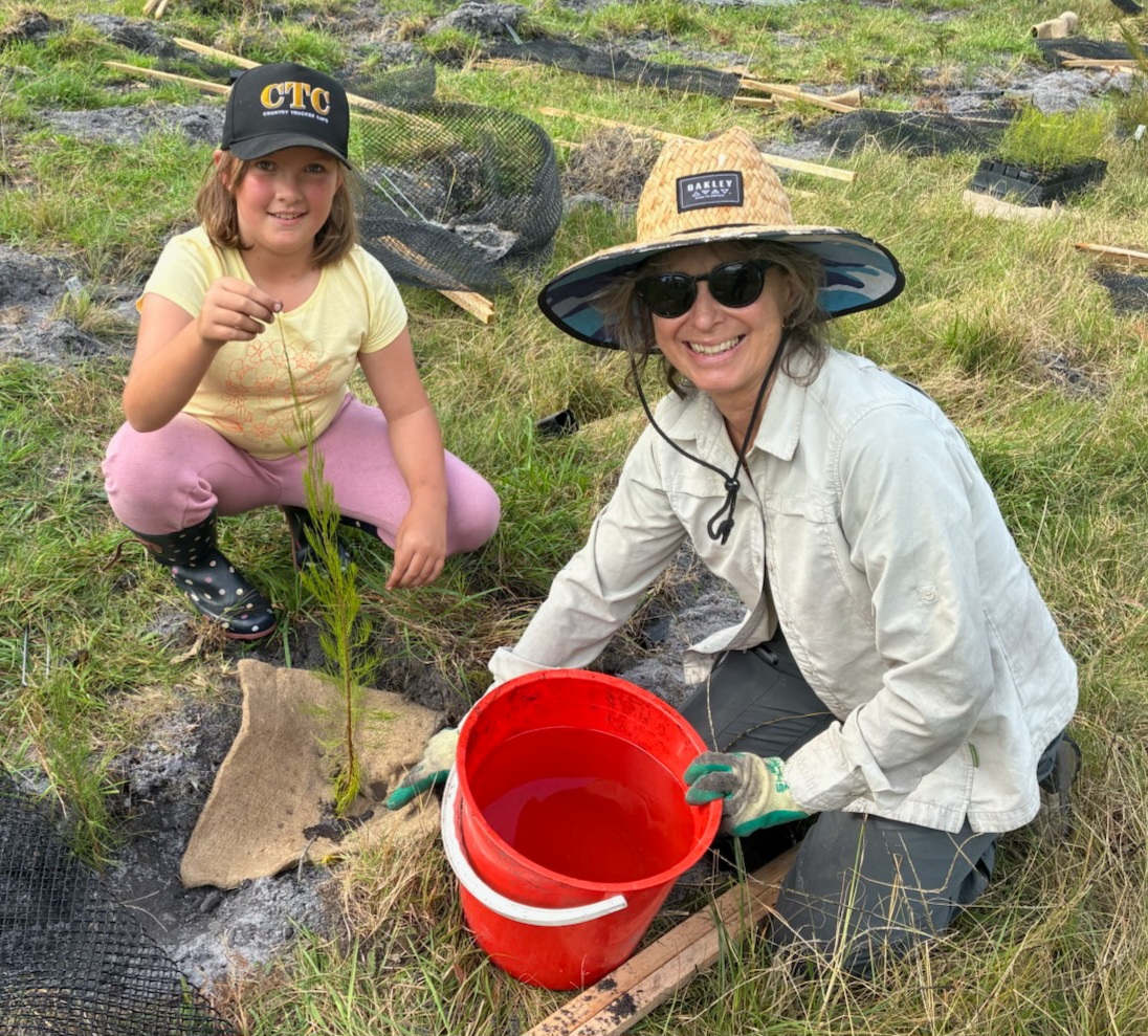
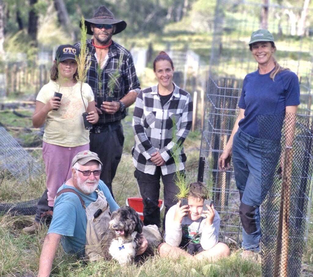
Next generation conservationists are getting involved in efforts to save the nationally threatened Glossy Black-cockatoo (Calyptorhynchus lathami) in Gippsland by participating in the Helping Hands for Sheoak project.
Freddie, Amelia and their parent (images below) recently joined a community planting day on Ted Dexter’s farm in Genoa, working hard all day to plant and guard Sheoaks to help save the Glossy.
“It is very inspiring when the younger generation turns up to help at a planting day,” said Dixie Fitzclarence from BioDiversity Legacy, a key partner in the project. “It provides a measure of hope for the future.”
Expanding stands of Black Sheoaks (Allocasuarina littoralis) through strategic revegetation of seedlings is an important recovery action for the nationally threatened Glossies, whose habitat was severely impacted in the 2019/20 bushfires, explained Dixie.
The Glossies feed almost exclusively on the seed cones of Allocasuarina species and, in eastern Victoria, Black Sheoaks are the predominant feed tree species. Many stands were burnt during the fires.
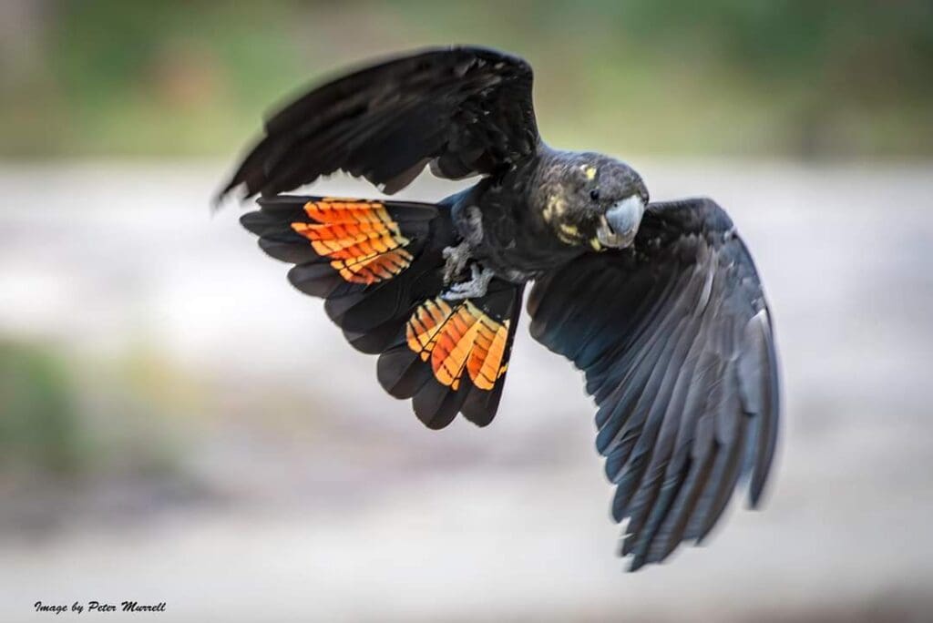
Photos. Top: Biodiversity Legacy Partnership & Grants Manager, Robyn Edwards, with Amelia. Above left: Helping Hands for Sheoak planting team from left –(back) Amelia, Fred, Esther Gatnau, Dixie Fitzclarence, Ted Dexter and Fred Jnr. Above right: A highlight of the planting day was a Glossy flying over the planting site. Photo: Peter Murrell.
Sheoaks can take up to 10 years to produce cones and even longer to grow branches thick enough to support the weight of Glossies feeding on them.
The Helping Hand for Sheoaks project, which is supported by the Natural Resource Conservation Trust (NRCT) and led by the Bairnsdale-based not-for-profit environmental consultancy, Wildlife Unlimited, is revegetating stands of Sheoaks on private land, building on Landcare, Birdlife and Department of Energy, Environment and Climate Action recovery works undertaken as part of the Black Summer bushfire response.
The planting is purposefully designed to connect State Forest with a protected covenanted forest, a priority habitat area.
“This project is a powerful investment into the future of the Glossy-black Cockatoo population in eastern Victoria as well as for the next generation, so that they too can enjoy and reap the biodiversity benefits of these types of revegetation projects,” added Dixie.
Project sites range from Lakes Entrance and Marlo through to Wangarabell and Genoa.
Wildlife Unlimited project lead, Esther Gatnau, said the community was getting behind the project.
“There are many helping hands for this project. Project partners include landholders, Far East Victoria Landcare Group, Sailors Grave Brewery, Moogji Aboriginal Council, East Gippsland Rail Trail, Friends of Mallacoota, BioDiversity Legacy and Rendere Environmental Trust,” said Esther.
Connecting efforts to restore South Coast ecosystems
Biodiversity Legacy (BDL) continues to build networks and engage with conservation communities on the Far South Coast of NSW from Eden to Tathra, Bermagui to Moruya, and beyond. This may be one of most beautiful regions in Australia, but it faces numerous threats to its biodiversity, from habitat loss to logging, agricultural activities, invasive species and impacts from bushfires.
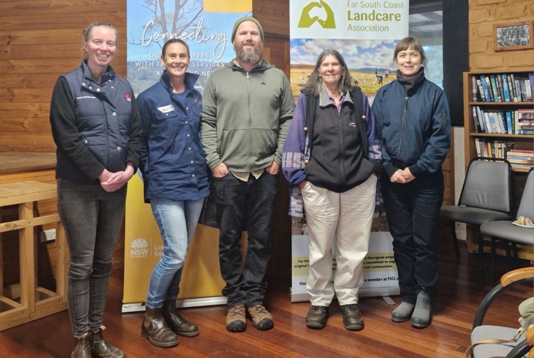
In June, BDL Contracts Manager & Southern NSW BioLink Coordinator, Dixie Fitzclarence, and BDL Partnership and Grants Manager, Robyn Edwards, headed to the small town of Towamba, near Bega, to meet the community and participate in a workshop aimed at helping them identify critically endangered Threatened Ecological Communities (TEC) within the River Flat Eucalypt Forest.
The event, coordinated by the Towamba Valley Landcare Group in association with the Far South Coast Conservation Management Network, involved presentations by Jackie Miles, a highly knowledgeable local botanist who explained the main diagnostic features of the TEC, South East Local Land Services Officer, and Annie Hobby, who provided an update on the status, range and distribution of this TEC and what communities can do to restore these ecosystems.
Dixie talked about BDL’s role supporting landholders, community groups, environmental organisations and others to protect the land they love for future generations. Robyn’s talk focused on BDL-supported work with Wildlife Unlimited to protect threatened species, including the Spot-tailed Quoll and Brush-tailed Rock Wallaby, as well as plans to extend this work to protect native species across a broad region, from Victoria to the South Coast.
“It was an inspiring day, connecting with landholders who are undertaking protection and restoration activities on their property or in the local landscape and to share with the community the role BDL has to play in permanent protection through facilitating community ownership of significant biodiverse areas,” said Robyn.
The event was supported by the Australian Government Natural Heritage Trust and the Saving Native Species Program delivered by South East Local Land Services, a member of the Commonwealth Regional Delivery Partners panel.
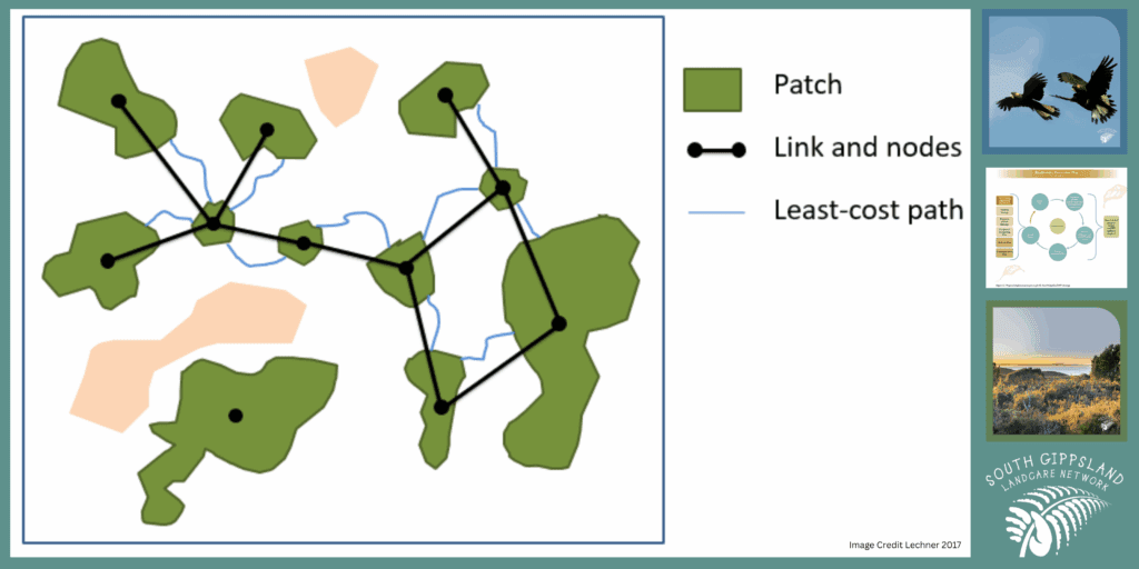
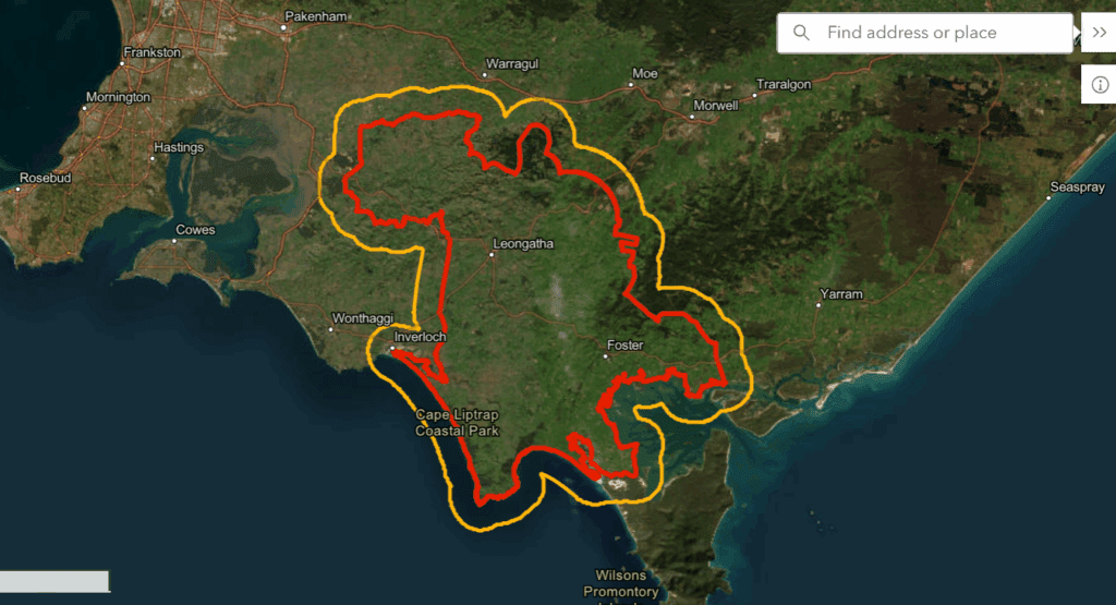
Landholders and nature lovers across South Gippsland Victoria are being encouraged to contribute to a biolink map being developed by the South Gippsland Landcare Network (SGLN) to give landholders and the broader community a bird’s eye view of the ‘patches, stepping stones and habitat links’ that need to be strengthened to create more effective wildlife corridors and protect native and threatened species.
The map is a key action of the SGLN’s 10-year Biodiversity Protection Plan developed in 2024 with cross-sector input, including from our Ecolands Collective colleagues, Prom Coast Ecolink, which sits under the umbrella of the SGLG, and the Gippsland Threatened Species Action Group, which aims to connect remnant patches of native vegetation, initially across the Bass Coast and now extending eastwards to South Gippsland.
Conservation action across this vast 262,000 ha region, which stretches from the steep Strzelecki Ranges in the north to the lowland coast in the south, is becoming increasingly urgent as just 22% of South Gippsland’s native vegetation remains, and 10% of all native species are now threatened.
After securing funding for two key phases of the mapping project, SGLN appointed mapping experts who, as a first step, are gathering base data via a ‘Habitat Near You’ website that asks landholders and community members to identify habitat hotspots, sightings of key species and key areas of interest (this phase will run from May to June 2025, so please contribute if you can).
Biodiversity Legacy South Gippsland Biolink Coordinator, and local community member, Stuart Inchley, will contribute data about remnant patches of vegetation north of Foster and contribute in other ways.
It will take about nine months to gather the foundational data. From here, the team will use the General Approach to Planning Connectivity from Local Scales to Regional (GAPCLoSR) GIS method to analyse landscape conditions and determine the best possible pathways for recreating or enhancing habitat for 4-6 target species.
The whole process will take a community-led, tenure blind approach and consider all environments across the region, not just those where larger patches of bushland exist.
Biodiversity Legacy welcomes this biolinking initiative, which reflects our long connection to the region and our commitment to engaging property owners and communities in conversations about the need to secure land and connect it to adjacent properties and/or state and national parks.
The map will also provide a well-informed basis for regional planning processes and inspire more investment in the natural values of our landscape.
A biodiversity legacy for Victoria’s southeast coast
The Nature Recovery Foundation (NRF) is a bold initiative committed to reversing biodiversity decline on Victoria’s Bass Coast and protecting the natural environment for future generations. The NRF is a partnership between Bass Coast Shire and Biodiversity Legacy, with each organisation having two directors on the board.
The Foundation’s initial focus is on tracts of land within the Bass Coast Shire, where the aim is to protect and enhance existing habitats while accelerating large-scale landscape restoration. As the Foundation grows, there may be opportunities to expand our impact beyond this region, most likely into South Gippsland.
The NRF is currently working towards Deductible Gift Recipient status, which will strengthen the Foundation’s legitimacy and open opportunities for tax-deductible donations, further supporting our long-term goals.
The Foundation’s Mission
To achieve lasting environmental restoration, the NRF will:
Protect priority areas of remnant biodiversity.
Secure and restore land with high ecological potential.
Create viable habitat refuges connected through biolinks.
Leverage partnerships and green investment for long-term sustainability.
Build a lasting legacy for future generations.
Next steps
This is an exciting step for Biodiversity Legacy, as several members of the team live in the adjacent shire of South Gippsland and, as a group, we have deep links to other environmental non-profits via our connection to the Ecolands Collective.
Stay tuned for more updates on the NRF in the coming months (as at March 2025).
Since the mid-1970s, conservationists, planners and land managers have been directing their attention to the formation of regional biolinks as an intuitively appealing way of slowing the decline of biodiversity in Australia, a continent that has lost over 40% of its forests since colonisation – 70 to 80% in states like Victoria.
Also known as greenways, green belts, shelterbelts and wildlife corridors, the biolink concept resonates because it is easy to understand.
In his highly influential book, Linkages in the Landscape, La Trobe University conservation researcher, Andrew F Bennett, notes the appeal of biolinks as “a visible solution to a visible problem – habitat fragmentation is generally a strikingly-obvious process. Equally, habitat corridors are a visible sign of efforts to ‘mend’ the fragmented landscape (‘bandages for a wounded natural landscape’ – Soulé and Gilpin 1991).”
He also notes that the ability to establish biolinks at different scales gives local communities the feeling they can ‘do something about’ the damage in their local environment and see visible results.
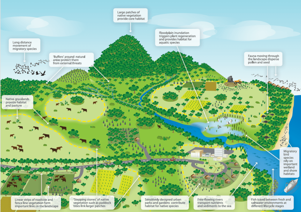
Department of Climate Change, Energy, the Environment and Water diagram showing landscape elements that contribute to wildlife corridors.
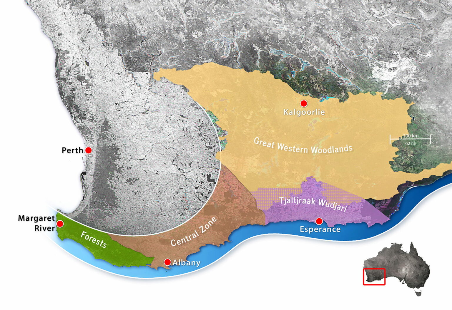
Gondwana Link project in south-western Australia.
Do biolinks actually work?
The rapid uptake of biolink projects around the world initially outpaced scientific understanding and data collection. Questions were raised about their effectiveness, particularly given the scarcity of conservation resources. Multiple studies were conducted looking at the key domains of:
Landscape connectivity – the physical connections between habitats across a landscape.
Habitat connectivity – connections between patches of habitat (‘stepping stones’) suitable for specific species.
Ecological connectivity – the function of ecosystems across space and time.
Evolutionary connectivity – allowing populations to interact naturally, breed and strengthen genetic diversity.
In 2010, the first meta-analysis was published. It showed that corridors increase migration between habitat patches by as much as 50%. Ten years later, a second analysis was done to solve questions raised in the first analysis. It found that, although not all corridors worked as planned, overall corridors effectively increase species movement, fitness and richness. This further translated into an increase in community biodiversity.
Macro (large scale) biolinks
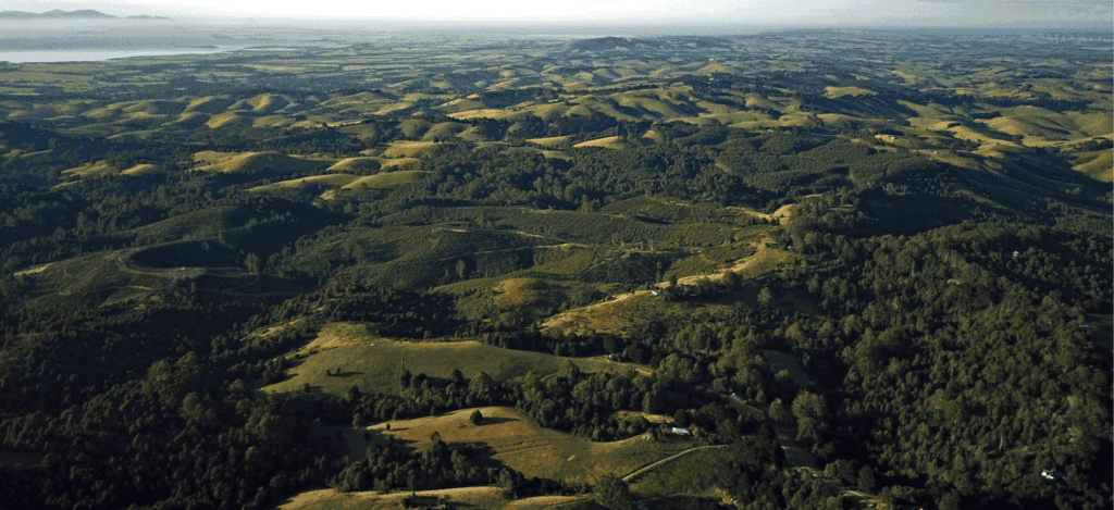
Beginning in the early 2000s, up to a dozen large-scale biolinks were proposed or established in Australia, one of the earliest being the Gondwana Link project in south-western Australia. Conceived by a small group of conservationists in 2000, the program now coordinates dozens of separate conservation projects along a 1,000 km corridor from the forests of Margaret River to the semi-arid woodlands and Mallee country bordering the Nullarbor Plain.
In 2005, Greening Australia began shaping up its Habitat 141 project; a 50-year collective response to habitat fragmentation and climate change along the 141st longitude stretching from the coast of South Australia, along the Victorian border, and up to the rugged rangelands of New South Wales.
Noting the success of these and other projects and how they might be connected to the National Reserve System (a network of more than 10,000 Commonwealth, state and territory protected areas), in 2012 the Australian Government published a National Wildlife Corridors Plan. Information on that plan is now difficult to find online. The program appears to have been folded into one of the most ambitious initiatives of all – the Great Eastern Ranges biolink.
This impressive program seeks to conserve and manage a 3,600 km ‘continental lifeline’ of habitats, landscapes and people from the Grampians in western Victoria, along the Great Divide and Eastern Escarpment of New South Wales and the Australian Capital Territory, to the wet tropics and remote Cape York Peninsula in Queensland’s far northeast.
Over 250 regional, state and national organisations have chosen to align their activities with the GER vision. Among them is the Biolinks Alliance, which performs a unique role as a capacity and partnership-building organisation consisting of 18 member Landcare networks working mostly in Central Victoria.
The missing link – community-based conservation
Australian National University researcher, Carina Wyborn, has been studying conservation connectivity since the early 2000s. Many of the themes she discusses in her publications discuss the challenges of collaboration.
“Without people working together, connectivity initiatives will go nowhere (Lovett et al. 2008), thus collaboration and community-based conservation are central.
“Centred in an ethic of place, community-based conservation is underpinned by the premise that local populations have a greater interest in and knowledge of local contexts … further, “by placing these local contributions within a larger picture (e.g large-scale programs), gives conservation on private land greater purpose.”
Paddock-scale connections
For decades, individual landholders have been working with organisations like Landcare to restore and protect pockets of habitat on private land. This work is critical, given that over 60% of all land in Australia is privately owned or managed (farms, pastoral leases and mines) and that 70% to 90% of inadequately protected wildlife is found on private land.
However, it has sometimes been difficult to see these activities within a broader vision.
Given their commitments to sustainability and better environmental management, many councils are stepping up to fill critical gaps, offering incentives to landholders and practical tools such as maps. A great example of this is Cardina Shire Council’s interactive map, which shows what has been done and what opportunities there are for improvement.
Biodiversity Legacy is also working with landholders and organisations across Australia, like Land Covenantors Victoria and Prom Coast Ecolink, to promote the connection of private landholdings and consider how they too can be tied into the vision we all share – protecting and connecting land for conservation and threatened species.