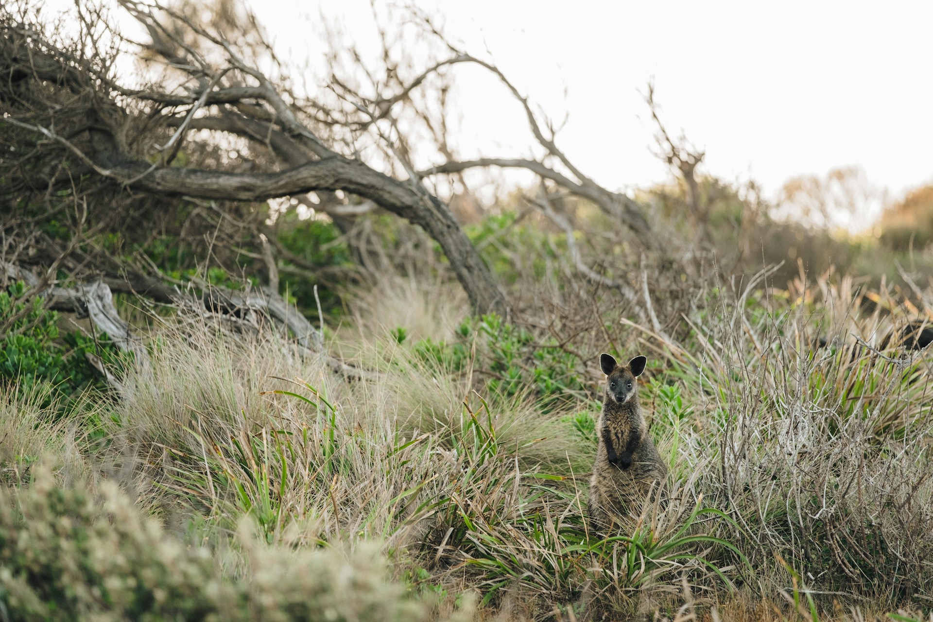
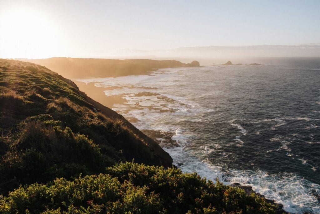
A biodiversity legacy for Victoria’s southeast coast
The Nature Recovery Foundation (NRF) is a bold initiative committed to reversing biodiversity decline on Victoria’s Bass Coast and protecting the natural environment for future generations. The NRF is a partnership between Bass Coast Shire and Biodiversity Legacy, with each organisation having two directors on the board.
The Foundation’s initial focus is on tracts of land within the Bass Coast Shire, where the aim is to protect and enhance existing habitats while accelerating large-scale landscape restoration. As the Foundation grows, there may be opportunities to expand our impact beyond this region, most likely into South Gippsland.
The NRF is currently working towards Deductible Gift Recipient status, which will strengthen the Foundation’s legitimacy and open opportunities for tax-deductible donations, further supporting our long-term goals.
The Foundation’s Mission
To achieve lasting environmental restoration, the NRF will:
Protect priority areas of remnant biodiversity.
Secure and restore land with high ecological potential.
Create viable habitat refuges connected through biolinks.
Leverage partnerships and green investment for long-term sustainability.
Build a lasting legacy for future generations.
Next steps
This is an exciting step for Biodiversity Legacy, as several members of the team live in the adjacent shire of South Gippsland and, as a group, we have deep links to other environmental non-profits via our connection to the Ecolands Collective.
Stay tuned for more updates on the NRF in the coming months (as at March 2025).
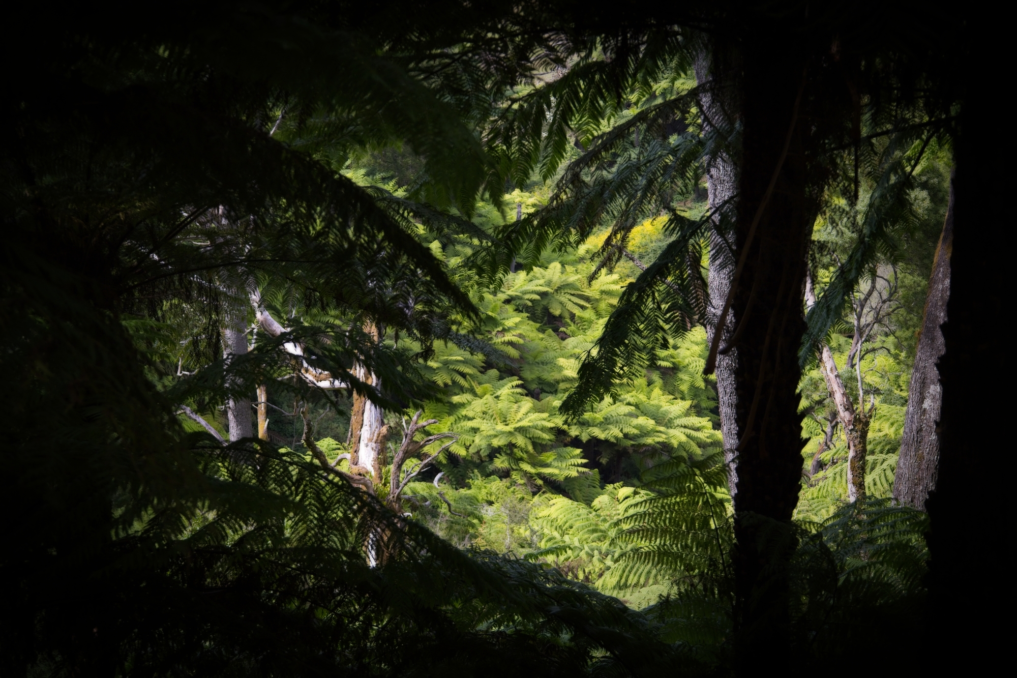
An ecological survey of rainforest communities on three Trust for Nature properties north of Foster in South Gippsland, as well as an adjacent state-run reserve, has found the largest population of Slender Tree-ferns ever documented in Australia, as well as rare and endangered species including the Netted Brake fern, Butterfly Orchid, over 100 indigenous plants and 40 mosses.
The survey, initiated by the Gippsland Threatened Species Action Group (GTSAG) and Tarwin River Forest Land Stewards, Victoria Johnson and Stuart Inchley (Biodiversity Legacy South Gippsland regional coordinator), was conducted by two of Victoria’s most experienced ecologists and botanists, Karl Just and Dylan Osler, with funding from the Wettenhall Environmental Trust and the Friends of Turtons Creek.
An engaged community
In February, the results of the survey were presented to an audience of over 80 people at the Foster War Memorial Arts Centre, including senior members of the Shire Council, business leaders, ecologists, botanists and residents. The presentation was also recorded (see above).
The event allowed Karl and Dylan to talk about the importance of private land in biodiversity conservation, as many areas remain under-surveyed compared to public lands.
“Dylan and I have both been working in ecology for over 20 years,” explained Karl.
“We get to wander around Victoria studying different ecosystems … but this [project] was quite a treat for us to do because we rarely gain access to private properties … which have an important role to play in maintaining regional biodiversity.”
Diversity is strength
The team spent more than a week exploring two distinct areas – the Turtons Creek Scenic Reserve (managed by Parks Victoria) and three adjacent Trust for Nature properties.
Walking 10 km over tough terrain, including steep, wet rainforest gullies, Karl and Dylan looked for and mapped rainforest boundaries, threatened species and created a list of observed flora.
Given the high rainfall in the area, ferns grow aplenty, but it was the diversity of the fern population that surprised them.
“You almost get these mini-ecosystems, with lots of different fern species growing on trees and branches – trees on trees. It’s kind of magical,” said Karl.
Geological features of the study area, including the presence of fault lines and unique sedimentary layers, contribute to the diverse ecosystems within the rainforest.
Understanding these geological factors is essential for effective conservation planning said Karl, as they influence vegetation patterns and habitat characteristics. He also noted how Cool Temperate Rainforest is highly sensitive to fire, with historical data indicating that it takes over 400 years for these ecosystems to recover. This long recovery period necessitates proactive fire management strategies to prevent devastating impacts on these vulnerable environments.
The survey also acknowledged the presence of invasive species such as blackberries, which can alter soil chemistry and microclimates, threatening the integrity of rainforest ecosystems. Additionally, evidence of deer populations was noted, which can contribute to vegetation degradation through browsing and trampling, necessitating ongoing management efforts.
To ensure the long-term health of Cool Temperature Rainforest, the survey recommends implementing protective buffers around rainforest areas, particularly near adjacent timber harvesting operations. Such buffers can mitigate risks from wind throw, herbicide drift, and invasive species, thereby supporting the resilience of these ecosystems.
The survey results underscore the beauty and importance of this landscape, while also raising awareness of the ongoing threats to its preservation.
Since the mid-1970s, conservationists, planners and land managers have been directing their attention to the formation of regional biolinks as an intuitively appealing way of slowing the decline of biodiversity in Australia, a continent that has lost over 40% of its forests since colonisation – 70 to 80% in states like Victoria.
Also known as greenways, green belts, shelterbelts and wildlife corridors, the biolink concept resonates because it is easy to understand.
In his highly influential book, Linkages in the Landscape, La Trobe University conservation researcher, Andrew F Bennett, notes the appeal of biolinks as “a visible solution to a visible problem – habitat fragmentation is generally a strikingly-obvious process. Equally, habitat corridors are a visible sign of efforts to ‘mend’ the fragmented landscape (‘bandages for a wounded natural landscape’ – Soulé and Gilpin 1991).”
He also notes that the ability to establish biolinks at different scales gives local communities the feeling they can ‘do something about’ the damage in their local environment and see visible results.
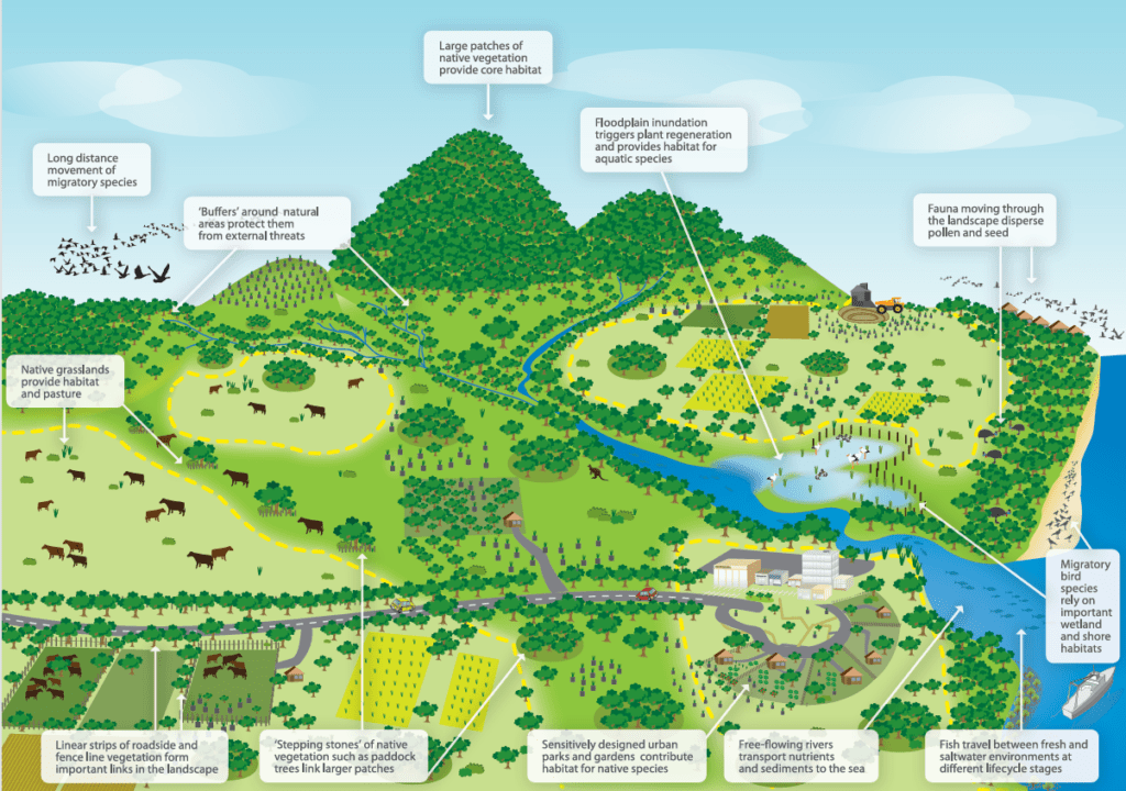
Department of Climate Change, Energy, the Environment and Water diagram showing landscape elements that contribute to wildlife corridors.
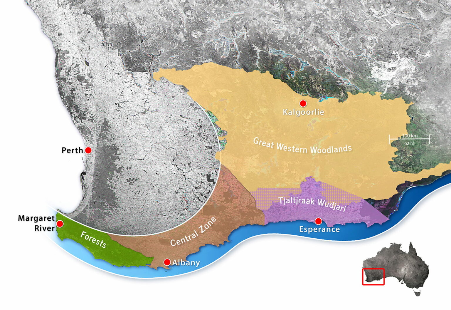
Gondwana Link project in south-western Australia.
Do biolinks actually work?
The rapid uptake of biolink projects around the world initially outpaced scientific understanding and data collection. Questions were raised about their effectiveness, particularly given the scarcity of conservation resources. Multiple studies were conducted looking at the key domains of:
Landscape connectivity – the physical connections between habitats across a landscape.
Habitat connectivity – connections between patches of habitat (‘stepping stones’) suitable for specific species.
Ecological connectivity – the function of ecosystems across space and time.
Evolutionary connectivity – allowing populations to interact naturally, breed and strengthen genetic diversity.
In 2010, the first meta-analysis was published. It showed that corridors increase migration between habitat patches by as much as 50%. Ten years later, a second analysis was done to solve questions raised in the first analysis. It found that, although not all corridors worked as planned, overall corridors effectively increase species movement, fitness and richness. This further translated into an increase in community biodiversity.
Macro (large scale) biolinks
Beginning in the early 2000s, up to a dozen large-scale biolinks were proposed or established in Australia, one of the earliest being the Gondwana Link project in south-western Australia. Conceived by a small group of conservationists in 2000, the program now coordinates dozens of separate conservation projects along a 1,000 km corridor from the forests of Margaret River to the semi-arid woodlands and Mallee country bordering the Nullarbor Plain.
In 2005, Greening Australia began shaping up its Habitat 141 project; a 50-year collective response to habitat fragmentation and climate change along the 141st longitude stretching from the coast of South Australia, along the Victorian border, and up to the rugged rangelands of New South Wales.
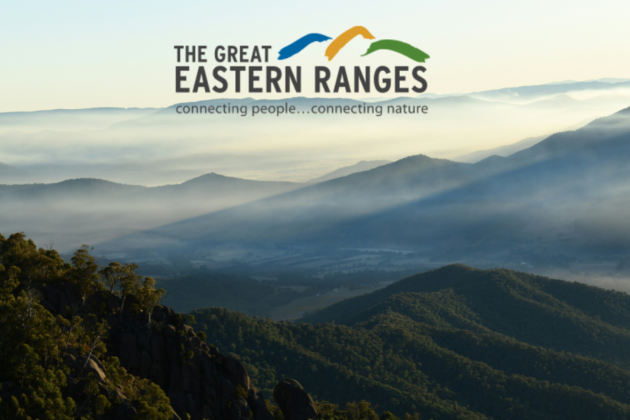
Noting the success of these and other projects and how they might be connected to the National Reserve System (a network of more than 10,000 Commonwealth, state and territory protected areas), in 2012 the Australian Government published a National Wildlife Corridors Plan. Information on that plan is now difficult to find online. The program appears to have been folded into one of the most ambitious initiatives of all – the Great Eastern Ranges biolink.
This impressive program seeks to conserve and manage a 3,600 km ‘continental lifeline’ of habitats, landscapes and people from the Grampians in western Victoria, along the Great Divide and Eastern Escarpment of New South Wales and the Australian Capital Territory, to the wet tropics and remote Cape York Peninsula in Queensland’s far northeast.
Over 250 regional, state and national organisations have chosen to align their activities with the GER vision. Among them is the Biolinks Alliance, which performs a unique role as a capacity and partnership-building organisation consisting of 18 member Landcare networks working mostly in Central Victoria.
The missing link – community-based conservation
Australian National University researcher, Carina Wyborn, has been studying conservation connectivity since the early 2000s. Many of the themes she discusses in her publications discuss the challenges of collaboration.
“Without people working together, connectivity initiatives will go nowhere (Lovett et al. 2008), thus collaboration and community-based conservation are central.
“Centred in an ethic of place, community-based conservation is underpinned by the premise that local populations have a greater interest in and knowledge of local contexts … further, “by placing these local contributions within a larger picture (e.g large-scale programs), gives conservation on private land greater purpose.”
Paddock-scale connections
For decades individual landholders have been working with organisations like Landcare to restore and protect pockets of habitat on private land. This work is critical, given that over 60% of all land in Australia is privately owned or managed (farms, pastoral leases and mines) and that 70% to 90% of inadequately protected wildlife is found on private land.
However, it has sometimes been difficult to see these activities within a broader vision.
Given their commitments to sustainability and better environmental management, many councils are stepping up to fill critical gaps, offering incentives to landholders and practical tools such as maps. A great example of this is Cardina Shire Council’s interactive map, which shows what has been done and what opportunities there are for improvement.
Biodiversity Legacy is also working with landholders and organisations across Australia, like Land Covenantors Victoria and Prom Coast Ecolink, to promote the connection of private landholdings and consider how they too can be tied into the vision we all share – protecting and connecting land for conservation and threatened species.
Through necessity, the early settlers viewed the Australian landscape through an economic lens, assessing the natural value of the land in terms of what they could extract from it.
Now, as we shift our focus to natural capital – the air, water, soil, plants and animals that essentially keep us alive – we are beginning to value more diverse landscapes. But not all get the attention they deserve.
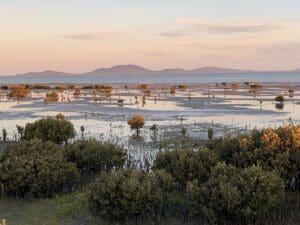
A case in point are the muddy, mucky landscapes known as coastal saltmarsh. Despite providing an astonishing array of ecosystem services, they remain greatly undervalued. But why?
Blue carbon landscapes
Broadly defined as a mosaic of coastal ecosystems, saltmarsh is one of the most productive ecosystems on Earth, likened to kidneys or lungs in terms of its ability to filter pollution and intercept nitrogen run-off from farms.
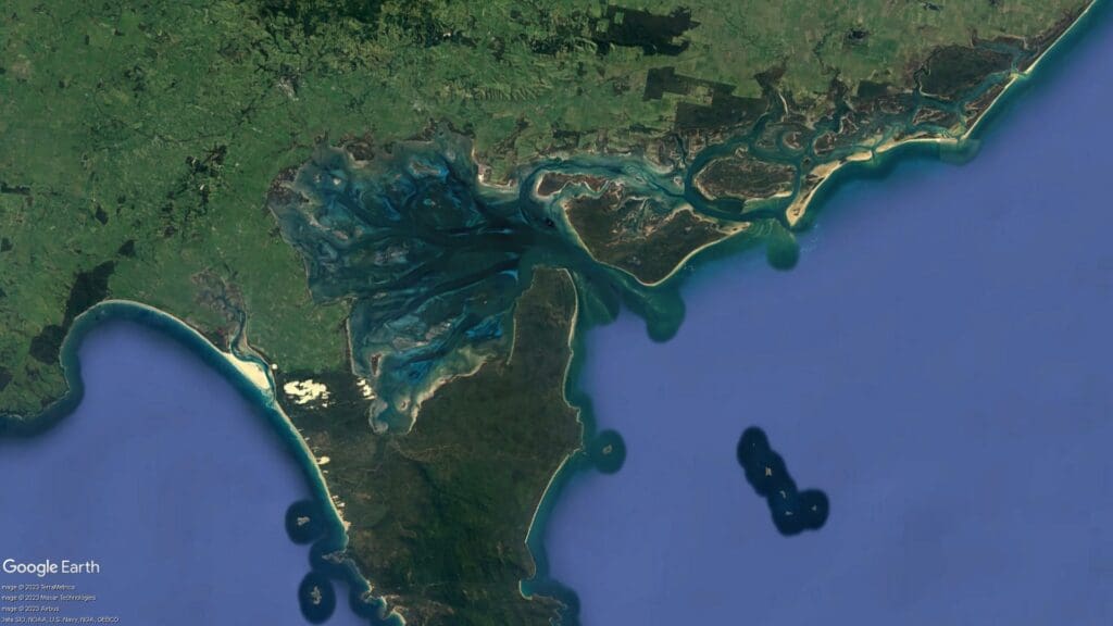
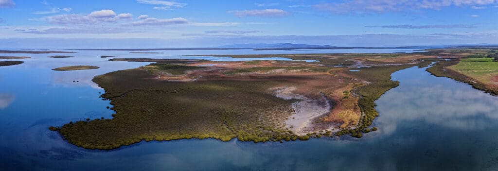
In South Gippsland Victoria, this lung effect can be seen from above as we look down at the 67,186-hectare site of Corner Inlet. Adjacent to Wilsons Promontory and the Nooramunga Marine and Coastal Park, Corner Inlet is one of 64 wetland areas listed as a Wetland of International Importance under Ramsar Convention.
Fringing the Inlet and the 40 plus sandy barrier islands within the inlet are some of the most floristically diverse coastal saltmarshes in the country; marshes that not only reduce farm run-off and provide a nursery for young fish, but capture and store carbon at rates 30-50 times higher than the equivalent area of soil in terrestrial forests – a process known as blue carbon.
Listen to Nooramunga Land & Sea Botanist, Karl Just, talk about key saltmarsh species.
Reframing notions of value
According to Melbourne University wetland ecologist, Paul L. Boon, Australians have always undervalued saltmarsh. He uses the folktale of Cinderella to describe how they are perceived as the ugly or poor stepsister of inland wetlands – wastelands standing between us and our desire to live on the coast and extract resources from it.
Viewed through European eyes, saltmarshes certainly ain’t pretty; in Cinderella’s words, “When they look at me, they see a mess”.
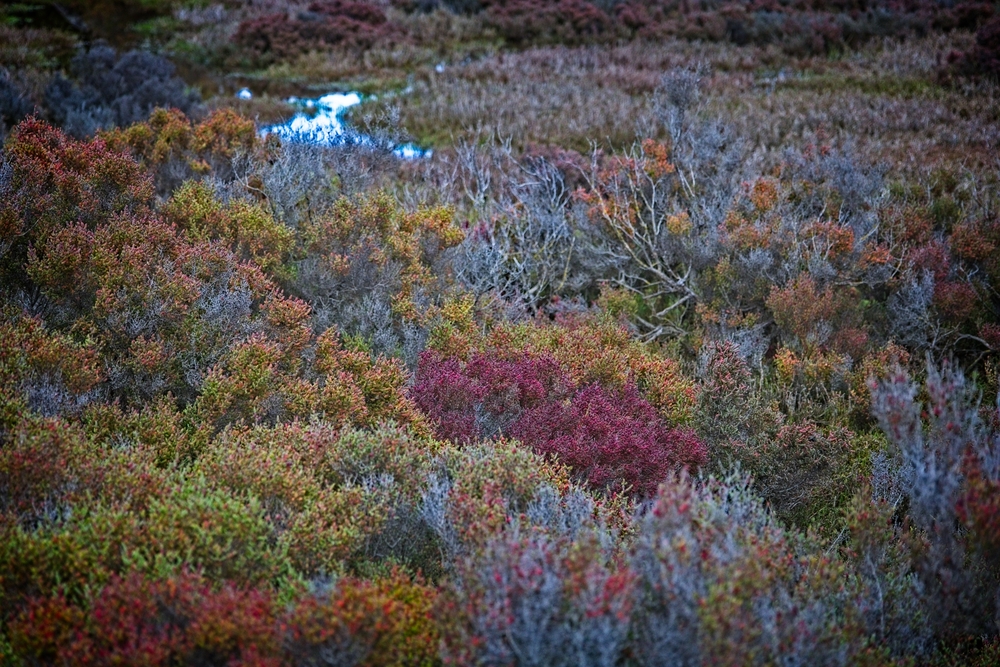
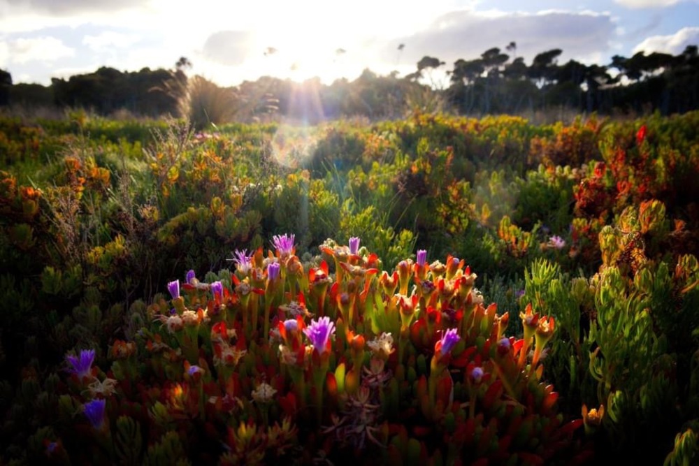
But if you look closer you can see the jewels in the landscape, like the samphire or glasswort whose jointed branches look like strings of coloured beads. Or the red seablite that mixes with the samphire to create rivers of red marsh.
A population at risk
While Corner Inlet retains 80% of its saltmarshes, a salutary lesson can be learned if we look west to Anderson Inlet, where 60% of the marshes have been lost. Or further north to Botany Bay – ironically named for its biodiversity – where losses in some areas are reported as 100%.
However, some plants within the Corner Inlet, including the iconic grey or white mangrove, are endangered. Perversely, if the saltmarshes are not managed well, the system gets out of balance and mangroves take over. So these systems need to be managed carefully.
An island of hope
In 2022, leading Victorian botanists Tim D’Ombrain and Karl Just got wind of a potential sale of Little Dog Island off the coast of Hedley within Corner Inlet.
Formerly owned by a group of developers who attempted to build an eco-resort on the island – complete with 9-hole golf course – the 62-hectare island was abandoned when the project failed. It lay idle for 14 years until Tim and Karl invited Federation University paleoecologist Professor Peter Gell, Rendere Environmental Trust Strategic Director Jim Phillipson and Carbon Landscapes co-director Dr Steve Enticott to collaborate on a new conservation project.
Together they formed a not-for-profit organisation called Nooramunga Land & Sea to hold the island in trust for future generations with provisions to enable community engagement and collective land stewardship.
The ‘saltmarsh crew’ are now repairing damage caused by the development and eradicating feral animals and weeds. They’re also investigating opportunities to secure other private properties in the area.
“We see these landscapes as ecological gems in the jewel that is Corner Inlet,” says Jim Phillipson. “They are beautiful and highly productive landscapes that support human health and wellbeing. But they are fragile and easy to disrupt. To protect them, we need to value them and promote their intrinsic value – just by being left alone.”
Like other areas within the Inlet, Little Dog Island attracts a wide range of migratory birds. It may also provide habitat for the critically endangered Orange-bellied Parrot, which feeds on plants that grow in salty or alkaline conditions such as saltmarshes.
Expectations are high that the Parrot will be spotted on Little Dog Island, with members of the conservation crew participating in BirdLife Australia’s Winter Surveys. The crew are also exploring opportunities to secure other properties in the Inlet to build biolinks and connections for plants, animals and people.
With thanks to Professor Paul Boon, whose research on saltmarsh is published in the CSIRO journal Marine & Freshwater Research and Royal Botanic Garden Sydney journal, Cunninghami