BioDiversity Legacy (BDL) is engaging with a growing number of landholders on the Far South Coast of New South Wales who are interested in exploring how BDL’s land protection pathways can not only safeguard individual properties but help communities connect their landscapes and expand their conservation ambitions.
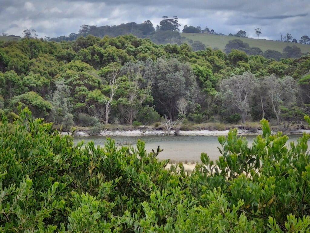
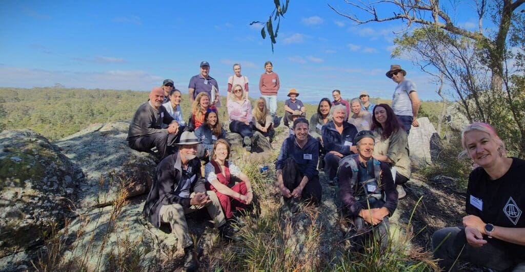
In October, BDL Communities & Stewardship Manager, Robyn Edwards, visited a remarkable 27-ha property adjoining Tilba Tilba Lake in the Gulaga/Eurobodalla region that has been lovingly restored over the past 45 years by members of the Tilba Lake Community (TLC).
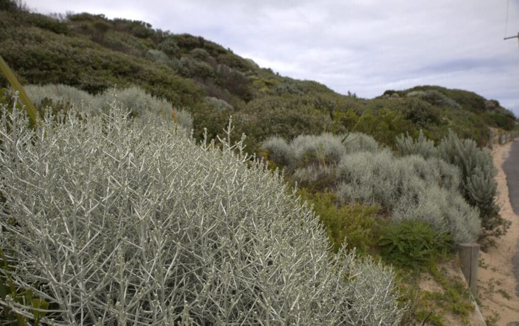
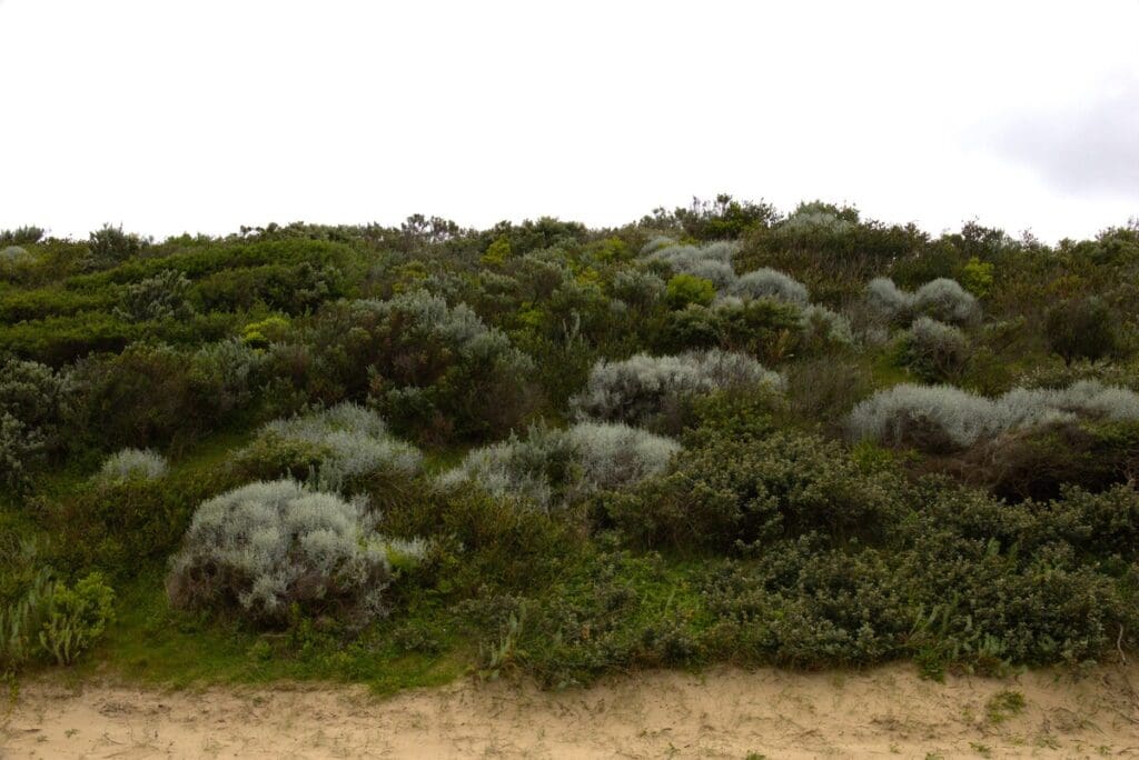
The property, once cleared and degraded, has been transformed into a thriving haven for biodiversity, with over 200 bird species recorded, a healthy Diamond Python population, returning Long-nosed Bandicoots and nationally endangered species, including the Glossy Black-Cockatoo and Hooded Plover.
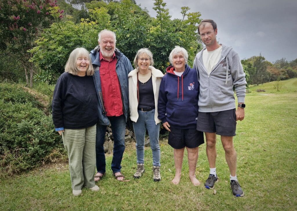
During the visit, Robyn joined Local Land Services NSW and TLC members Geoff Pryor, Noel Pratt, Dr Liz Dennis and her son, Dr Clancy Dennis, in a wide-ranging conversation about the property’s natural and cultural values, land transition pathways and the Biosphere Region proposal originally developed by the Tilba Environment Landcare Group as part of the Tilba Chamber of Commerce strategy review in the wake of the 2019–20 bushfires.
“A big part of our role at BioDiversity Legacy is guiding communities through a progression – from connection and learning to agency, active hope and, ultimately, positive, lasting conservation pathways,” says Robyn.
“It was inspiring to meet the landholders, learn about the Yuin people’s connection to Country and see how the Tilba property has been brought back to life. We’ll do what we can to support this group and the wider community to pursue their landscape vision.”
Photo right: Shareholders of the Tilba Lake Community Pty Ltd property enjoyed conversations with BioDiversity Legacy’s Robyn Edwards. Left to right: Noel and Geoff Pryor, Robyn Edwards, Liz Dennis and son Clancy.
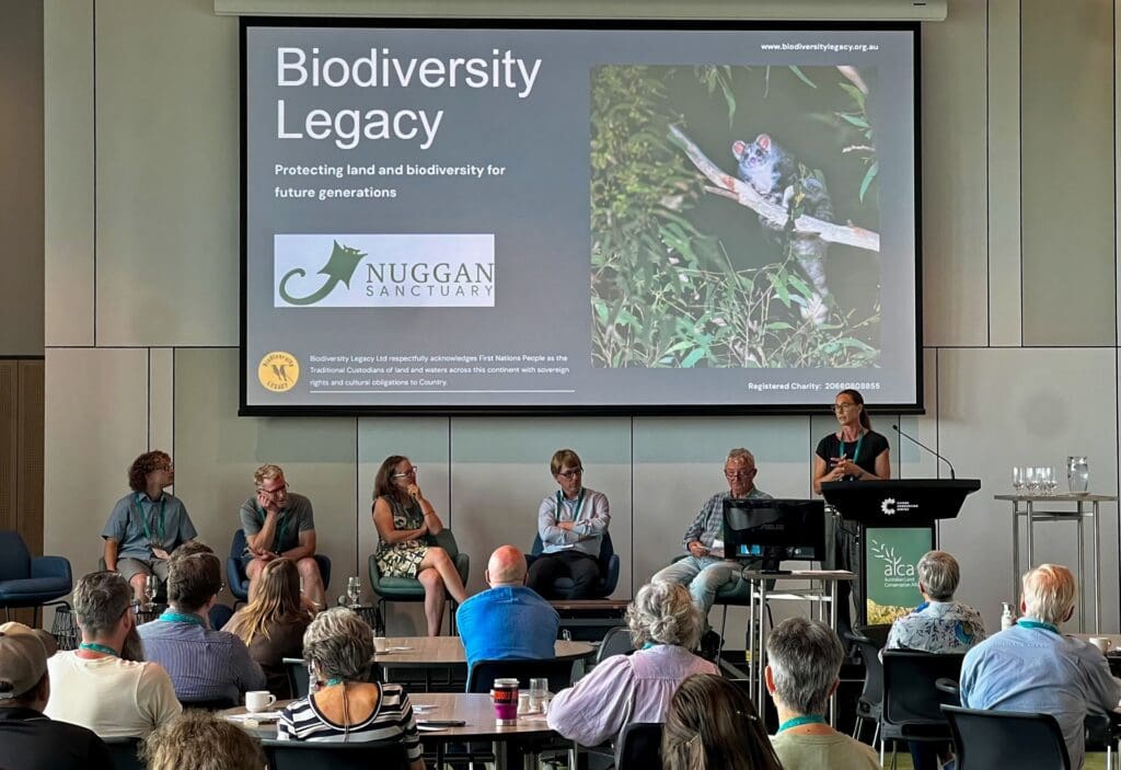
In October, BioDiversity Legacy joined landholders, Traditional Owners, scientists, and conservation organisations from around the country at the 2025 Australian Land Conservation Alliance Conference, held in Gimuy (Cairns).
The conference theme – Scaling Up: Local Action for Global Solutions – echoed what drives our work at BioDiversity Legacy every day: empowering and facilitating landholders and communities to protect the land they love – from early steps in land stewardship to formal and lasting protection.
Shared purpose and momentum
The Australian Land Conservation Alliance (ALCA) is the national peak body for organisations working in private land conservation, bringing together people who are actively restoring and safeguarding nature on privately managed land. This year’s event created a powerful space for sharing knowledge, building partnerships and exploring innovative models for long-term protection.
BioDiversity Legacy was proud to be announced as one of ALCA’s newest member organisations, alongside the National Landcare Network – a milestone that reflects our growing role in this national movement (see the full list of ALCA members here).
Contributing to the conversation
BioDiversity Legacy staff were delighted to play an active role in the Land Conservation Forum for Landholders on Tuesday, 7 October, with our Head of Conservation Engagement & Partnerships, Dixie Fitzclarence, co-presenting a session with Andrew and Angus Cleary from Nuggan Sanctuary, who shared their family’s inspiring conservation journey and their work to secure lasting protection for their land.
BioDiversity Legacy’s Far North Queensland Biolink Coordinator, Keith Smith (who is also involved in Queensland’s Private Protected Area Program), participated in the Ask an Expert session, offering insights into land management and conservation practices.
Inspired for what’s next
Says Dixie: “The week was filled with insight and connection. MC Sean Dooley kept spirits high and Peter Garrett’s closing remarks left the room energised for the road ahead. We left Cairns inspired and looking forward to reconnecting with everyone in Lutruwita/Tasmania next October for ALCA26 and in Naarm/Melbourne for the 2027 International Land Conservation Network Global Congress.”
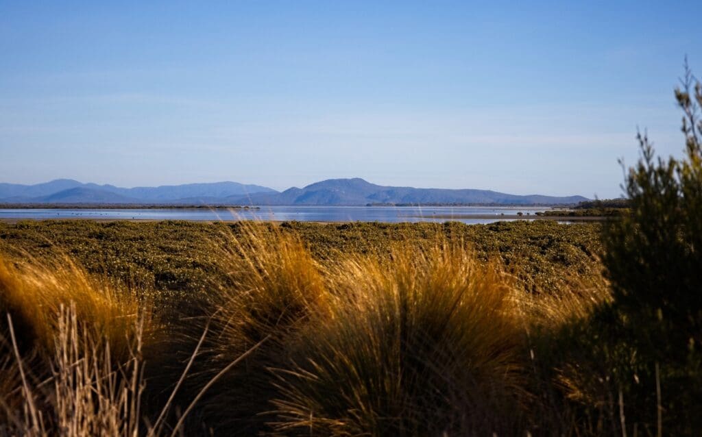
Biodiversity Legacy’s bold vision for protecting vulnerable ecosystems at scale is being realised in South Gippsland, where Nooramunga Land & Sea (NL&S) has acquired its second saltmarsh island.
A safe haven for migratory birds, small mammals and lizards and vulnerable saltmarsh plant communities
Bullock Island joins neighbouring Little Dog Island as part of a growing legacy of land protected within the iconic Corner Inlet – a Ramsar-listed wetland of international significance.
Both islands were previously zoned for farming and recreational use, placing over 132-ha (330-acres) of valuable coastal saltmarsh at risk. In fact, the 60-hectare Little Dog Island was previously developed as a golf resort, which caused significant damage.
With funding from the Upotipotpon Foundation and support from Biodiversity Legacy, the NL&S team secured the island, with the stewardship team about to conduct surveys and monitoring to see what’s on the island and undertake habitat restoration and enhancement works to protect vulnerable species and help them thrive.
Land protection and stewardship team
The NL&S team consists of leading ecologists, environmental philanthropists, carbon landscape experts and researchers with deep roots in ecological restoration and land protection. They include:
Jim Phillipson, Strategic Director of the Rendere Environmental Trust, also provided support for the initiative, with volunteers, local landholders, Traditional Owners, citizen scientists and community partners also invited to collaborate on efforts to protect these landscapes, which are vital for biodiversity, carbon storage and climate resilience.
A Living Mosaic
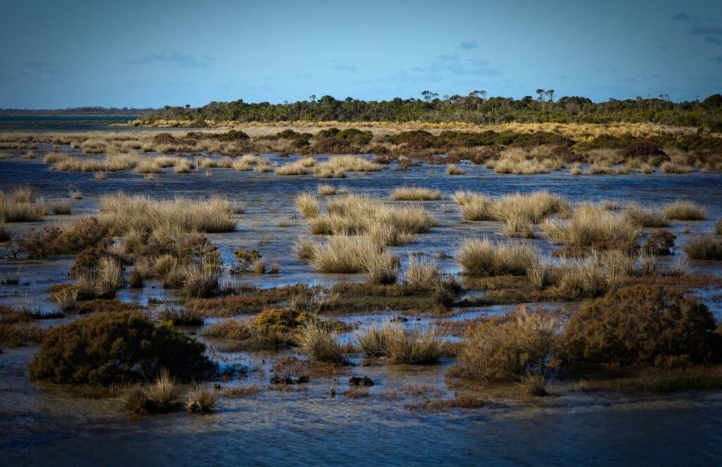
Framed by Wilson’s Promontory to the south and South Gippsland’s green hills to the north, the 72-ha Bullock Island presents a rich tapestry of native grasses, salt-tolerant shrubs, Swamp Paperbark and colourful succulents, such as Beaded and Shrubby Glassworts, Pigface, Austral Seablite and Austral Brooklime.
Like many of the sandy islands in Corner Inlet, Bullock Island’s intertidal mudflats and waters support large areas of White Mangrove and Broad-leafed Seagrass; communities of limited distribution in Victoria.
Sanctuary for rare and migratory birds
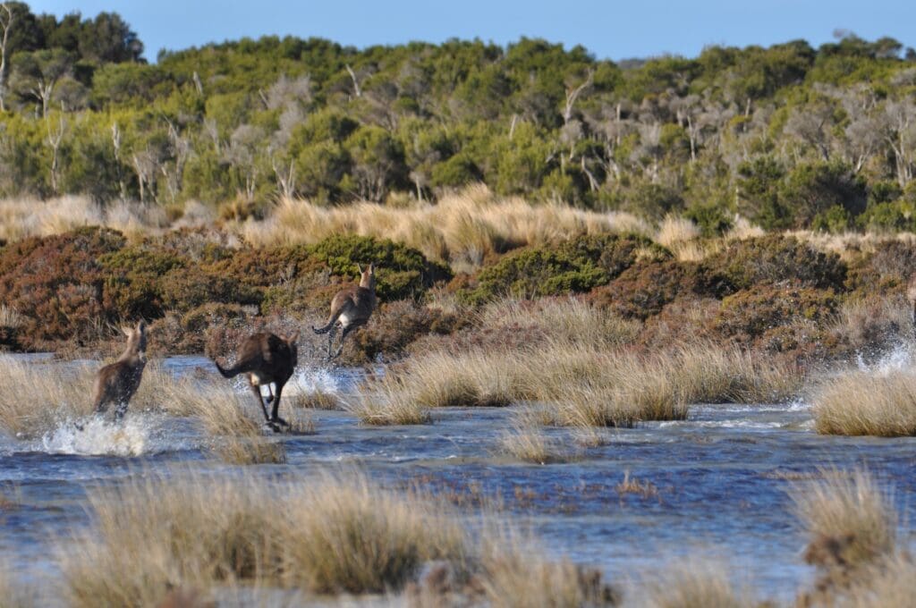
Corner Inlet is a haven for birdlife, supporting an estimated 20% of Victoria’s entire wader population. Now linked by intertidal flats, Bullock and Little Dog islands offer crucial safe habitat for several threatened species, including:
Critically Endangered: Far Eastern Curlew, Great Knot, Curlew Sandpiper
Endangered: Lesser Sand Plover, Red Knot
Vulnerable: Hooded Plover, Australian Grayling, Swift Parrot
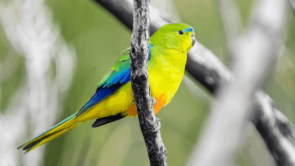
There is also quiet optimism that the islands may one day support the return of the Orange-bellied Parrot – one of Australia’s rarest birds. NL&S is working closely with BirdLife Australia and Zoos Victoria to monitor for the species’ presence and support its potential recovery.
Why these islands matter to us all
The value of these saltmarsh islands extends far beyond biodiversity. As part of the blue carbon ecosystem, their dense vegetation and deep, silty soils lock away carbon 30 to 50 times faster than terrestrial forests – keeping it stored for thousands of years.
They also provide:
storm surge protection for coastal towns
clean water by filtering nutrients and sediment
fish nurseries vital for local marine species and fisheries.
Protecting them means strengthening climate resilience, food systems and local economies.
A blueprint for community-led conservation
This project demonstrates what’s possible when innovative governance structures meet passion, purpose and place-based conservation.
The NL&S team anticipates further acquisitions to protect and restore connectivity between South Gippsland’s saltmarsh ecosystems as more landholders and philanthropists come on board.
At Biodiversity Legacy, we believe that real, lasting change happens when passionate people and organisations come together with a shared purpose. That’s why we’re proud to be part of the Ecolands Collective – a growing alliance of emerging and regional conservation groups working collaboratively to strengthen biolinks, support threatened species and drive some of the high-impact environmental projects highlighted below.
Partnering for Quoll Recovery in East Gippsland
One standout initiative is a bold Spot-tailed Quoll recovery project in East Gippsland, led by colleagues at the Bairnsdale-based ecological not-for-profit, Wildlife Unlimited (WUL).
This 10-year program, supported by the Victorian Government’s Nature Fund (2024), aims to rebuild local populations of this elusive apex predator, whose numbers have plummeted dramatically in recent decades. The project brings together a powerful consortium of experts, including ecologists, geneticists, First Nations communities, species reintroduction specialists and concerned government and non-government organisations.
The epicentre of this activity is the rugged Little River Gorge – a remote and vital stronghold for the species in East Gippsland. Here, field ecologists trek deep into the bush to monitor populations, explore reintroduction options and advocate for landscape-scale recovery efforts.
Importantly, quoll conservation has broader ecological benefits, with recovery actions expected to support 17 nationally listed and over 150 state-listed threatened species – including the Brush-tailed Rock-wallaby, Southern Brown Bandicoot, Southern Greater Glider, Glossy Black-Cockatoo, and Powerful Owl [to find out more, or to donate to the Quoll Recovery Project »].
Restoring Sheoak for Glossy Black-Cockatoos
Still in East Gippsland – a region continuing to recover from the 2019/20 bushfires – Biodiversity Legacy is supporting the Helping Hands for Sheoak project, which is restoring feeding habitat for the endangered Glossy Black-Cockatoo, which feeds almost exclusively on Sheoak seeds.
This collaborative effort builds upon previous work carried out by DEECA and Birdlife Australia and includes participation by Wildlife Unlimited, Biodiversity Legacy, Far East Victoria Landcare, Moogji Aboriginal Council and Friends of Mallacoota. By supporting landholders, this project delivers both ecological restoration and community empowerment, contributing to species recovery across a fragmented landscape [learn more about Helping Hands for Sheoak »].
Nature Recovery Along the Bass Coast
On Victoria’s Bass Coast, just 14% of native vegetation remains, but a bold new initiative is turning the tide. The Nature Recovery Foundation (NRF), co-founded by Bass Coast Shire and Biodiversity Legacy, is working with landholders and the wider community to halt biodiversity loss and strengthen wildlife corridors. This whole-of-community approach is designed to deliver enduring outcomes, rooted in local stewardship and landscape-scale thinking.
Grassroots Action and Long-term Protection
Our collaboration doesn’t stop there. Through the Ecolands Collective, we’re also proudly associated with the Gippsland Threatened Species Action Group – a volunteer-driven Landcare organisation monitoring and protecting native species along the Bass Coast. With decades of grassroots experience and deep regional ties, their work is vital to raising awareness of local species and building regional biolinks [learn more about the Gippsland Threatened Species Action Group »].
We’re also connected to Land Covenantors Victoria (LCV), a member-based organisation helping landholders protect biodiversity on private land through Trust for Nature conservation covenants. LCV’s aligned vision supports the Biodiversity Legacy mission to see more land protected, and we love referring landholders to LCV to begin or enhance their covenanting journey. [Learn more about Land Covenantors Victoria »]
The Power of Connection
Many of the organisations mentioned – including Biodiversity Legacy – are relatively young, but by working together under the Ecolands Collective banner, the ripple effects are starting to show.
“By being part of a collective of like-minded organisations, we’ve built strong partnerships and delivered initiatives already creating positive environmental and social impacts,” says Robyn Edwards, Biodiversity Legacy’s Grants & Partnerships Manager and East Gippsland Biolink Coordinator.
“Sharing a common vision means we can lift each other up, exchange knowledge and strategically identify where we can have the most impact. Together, we’re achieving more than we ever could alone.”
The Ecolands Collective is supported by the Rendere Environmental Trust, which has provided seed funding and operational support – from governance and ACNC registration to strategic advice and communications – to help these groups grow and thrive.
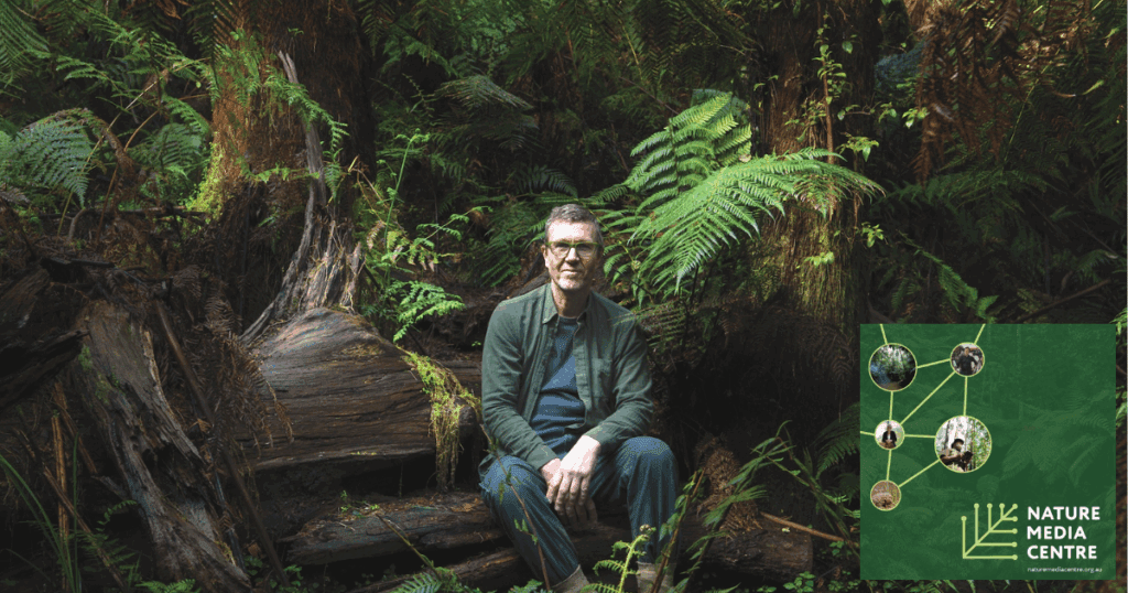
Congratulations to Biodiversity Legacy South Gippsland Biolink Coordinator, Stuart Inchley, who has been selected to join an august list of conservation experts in the new Nature Media Centre, a joint project of the Biodiversity Council, the Pew Charitable Trusts and the Australian Land Conservation Alliance.
The Nature Media Centre was recently established as a ‘non-partisan resource’ to give journalists access to conservation experts working in areas as diverse as regenerative farming, art and design, land management, ecology, urban planning, academia, citizen science, Indigenous knowledge and even ‘astrotourism’.
Many of these individuals do not have high media profiles yet are highly influential in their local communities and are doing amazing things on the ground. As such, they are well placed to provide insights into the challenges and complexities of environmental protection and management.
In his capacity as Biolink Coordinator, Stuart is connecting landholders – many of whom are working in isolation – across South Gippsland, strengthening communities willing to restore and protect habitat on private land.
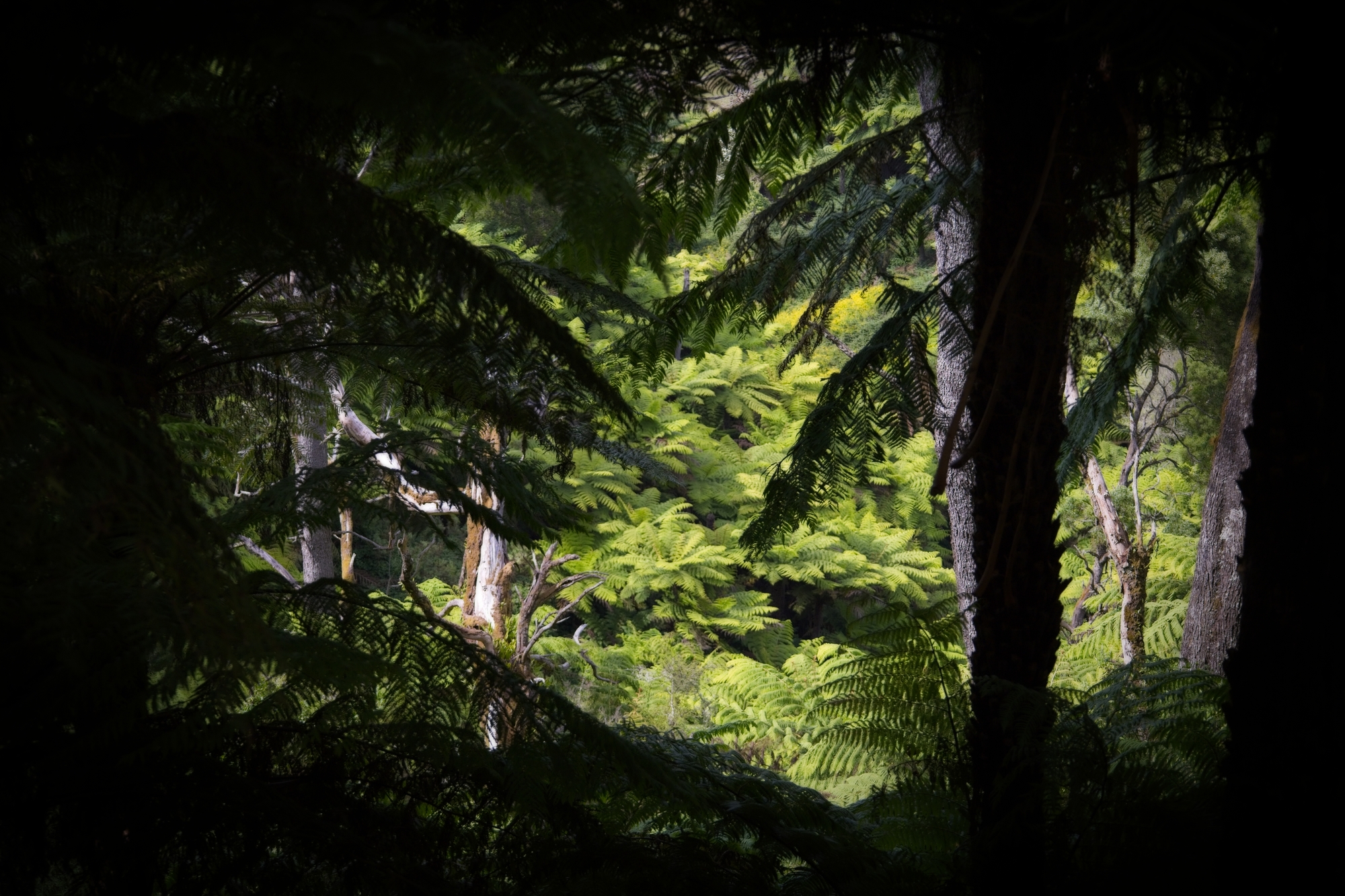
With partner Victoria, Stuart also looks after a 300-acre covenant-protected property, Tarwin River Forest, in South Gippsland. The property, which is home to many rare and threatened species such as the Gang-gang Cockatoo, Pilotbird and Strzelecki Burrowing Crayfish, has a significant population of Critically Endangered Slender Tree-ferns in some magnificent cool temperate rainforest gullies.
Stuart and Victoria have first-hand experience of the personal and financial challenges of stewarding private property for conservation, including threats from forestry, climate change and feral animals. They regularly bring the community together for events on the property, where they share their experiences, their love of these landscapes, community-led solutions and active hope.
Stuart joins Diana Droog, secretary of Land Covenantors Victoria, in the Nature Media Centre as a trusted voice for private land conservation.
We look forward to what Stuart, Diana and others have to say in the coming months as they shine a light on Australia’s unfolding environmental crisis and help newsmakers tell compelling stories that educate and inspire action.
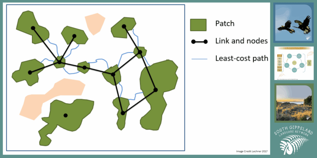
Landholders and nature lovers across South Gippsland Victoria are being encouraged to contribute to a biolink map being developed by the South Gippsland Landcare Network (SGLN) to give landholders and the broader community a bird’s eye view of the ‘patches, stepping stones and habitat links’ that need to be strengthened to create more effective wildlife corridors and protect native and threatened species.
The map is a key action of the SGLN’s 10-year Biodiversity Protection Plan developed in 2024 with cross-sector input, including from our Ecolands Collective colleagues, Prom Coast Ecolink, which sits under the umbrella of the SGLG, and the Gippsland Threatened Species Action Group, which aims to connect remnant patches of native vegetation, initially across the Bass Coast and now extending eastwards to South Gippsland.
Conservation action across this vast 262,000 ha region, which stretches from the steep Strzelecki Ranges in the north to the lowland coast in the south, is becoming increasingly urgent as just 22% of South Gippsland’s native vegetation remains, and 10% of all native species are now threatened.
After securing funding for two key phases of the mapping project, SGLN appointed mapping experts who, as a first step, are gathering base data via a ‘Habitat Near You’ website that asks landholders and community members to identify habitat hotspots, sightings of key species and key areas of interest (this phase will run from May to June 2025, so please contribute if you can).
Biodiversity Legacy South Gippsland Biolink Coordinator, and local community member, Stuart Inchley, will contribute data about remnant patches of vegetation north of Foster and contribute in other ways.
It will take about nine months to gather the foundational data. From here, the team will use the General Approach to Planning Connectivity from Local Scales to Regional (GAPCLoSR) GIS method to analyse landscape conditions and determine the best possible pathways for recreating or enhancing habitat for 4-6 target species.
The whole process will take a community-led, tenure blind approach and consider all environments across the region, not just those where larger patches of bushland exist.
Biodiversity Legacy welcomes this biolinking initiative, which reflects our long connection to the region and our commitment to engaging property owners and communities in conversations about the need to secure land and connect it to adjacent properties and/or state and national parks.
The map will also provide a well-informed basis for regional planning processes and inspire more investment in the natural values of our landscape.
A biodiversity legacy for Victoria’s southeast coast
The Nature Recovery Foundation (NRF) is a bold initiative committed to reversing biodiversity decline on Victoria’s Bass Coast and protecting the natural environment for future generations. The NRF is a partnership between Bass Coast Shire and Biodiversity Legacy, with each organisation having two directors on the board.
The Foundation’s initial focus is on tracts of land within the Bass Coast Shire, where the aim is to protect and enhance existing habitats while accelerating large-scale landscape restoration. As the Foundation grows, there may be opportunities to expand our impact beyond this region, most likely into South Gippsland.
The NRF is currently working towards Deductible Gift Recipient status, which will strengthen the Foundation’s legitimacy and open opportunities for tax-deductible donations, further supporting our long-term goals.
The Foundation’s Mission
To achieve lasting environmental restoration, the NRF will:
Protect priority areas of remnant biodiversity.
Secure and restore land with high ecological potential.
Create viable habitat refuges connected through biolinks.
Leverage partnerships and green investment for long-term sustainability.
Build a lasting legacy for future generations.
Next steps
This is an exciting step for Biodiversity Legacy, as several members of the team live in the adjacent shire of South Gippsland and, as a group, we have deep links to other environmental non-profits via our connection to the Ecolands Collective.
Stay tuned for more updates on the NRF in the coming months (as at March 2025).
An ecological survey of rainforest communities on three Trust for Nature properties north of Foster in South Gippsland, as well as an adjacent state-run reserve, has found the largest population of Slender Tree-ferns ever documented in Australia, as well as rare and endangered species including the Netted Brake fern, Butterfly Orchid, over 100 indigenous plants and 40 mosses.
The survey, initiated by the Gippsland Threatened Species Action Group (GTSAG) and Tarwin River Forest Land Stewards, Victoria Johnson and Stuart Inchley (Biodiversity Legacy South Gippsland regional coordinator), was conducted by two of Victoria’s most experienced ecologists and botanists, Karl Just and Dylan Osler, with funding from the Wettenhall Environmental Trust and the Friends of Turtons Creek.
An engaged community
In February, the results of the survey were presented to an audience of over 80 people at the Foster War Memorial Arts Centre, including senior members of the Shire Council, business leaders, ecologists, botanists and residents. The presentation was also recorded (see above).
The event allowed Karl and Dylan to talk about the importance of private land in biodiversity conservation, as many areas remain under-surveyed compared to public lands.
“Dylan and I have both been working in ecology for over 20 years,” explained Karl.
“We get to wander around Victoria studying different ecosystems … but this [project] was quite a treat for us to do because we rarely gain access to private properties … which have an important role to play in maintaining regional biodiversity.”
Diversity is strength
The team spent more than a week exploring two distinct areas – the Turtons Creek Scenic Reserve (managed by Parks Victoria) and three adjacent Trust for Nature properties.
Walking 10 km over tough terrain, including steep, wet rainforest gullies, Karl and Dylan looked for and mapped rainforest boundaries, threatened species and created a list of observed flora.
Given the high rainfall in the area, ferns grow aplenty, but it was the diversity of the fern population that surprised them.
“You almost get these mini-ecosystems, with lots of different fern species growing on trees and branches – trees on trees. It’s kind of magical,” said Karl.
Geological features of the study area, including the presence of fault lines and unique sedimentary layers, contribute to the diverse ecosystems within the rainforest.
Understanding these geological factors is essential for effective conservation planning said Karl, as they influence vegetation patterns and habitat characteristics. He also noted how Cool Temperate Rainforest is highly sensitive to fire, with historical data indicating that it takes over 400 years for these ecosystems to recover. This long recovery period necessitates proactive fire management strategies to prevent devastating impacts on these vulnerable environments.
The survey also acknowledged the presence of invasive species such as blackberries, which can alter soil chemistry and microclimates, threatening the integrity of rainforest ecosystems. Additionally, evidence of deer populations was noted, which can contribute to vegetation degradation through browsing and trampling, necessitating ongoing management efforts.
To ensure the long-term health of Cool Temperature Rainforest, the survey recommends implementing protective buffers around rainforest areas, particularly near adjacent timber harvesting operations. Such buffers can mitigate risks from wind throw, herbicide drift, and invasive species, thereby supporting the resilience of these ecosystems.
The survey results underscore the beauty and importance of this landscape, while also raising awareness of the ongoing threats to its preservation.
Since the mid-1970s, conservationists, planners and land managers have been directing their attention to the formation of regional biolinks as an intuitively appealing way of slowing the decline of biodiversity in Australia, a continent that has lost over 40% of its forests since colonisation – 70 to 80% in states like Victoria.
Also known as greenways, green belts, shelterbelts and wildlife corridors, the biolink concept resonates because it is easy to understand.
In his highly influential book, Linkages in the Landscape, La Trobe University conservation researcher, Andrew F Bennett, notes the appeal of biolinks as “a visible solution to a visible problem – habitat fragmentation is generally a strikingly-obvious process. Equally, habitat corridors are a visible sign of efforts to ‘mend’ the fragmented landscape (‘bandages for a wounded natural landscape’ – Soulé and Gilpin 1991).”
He also notes that the ability to establish biolinks at different scales gives local communities the feeling they can ‘do something about’ the damage in their local environment and see visible results.
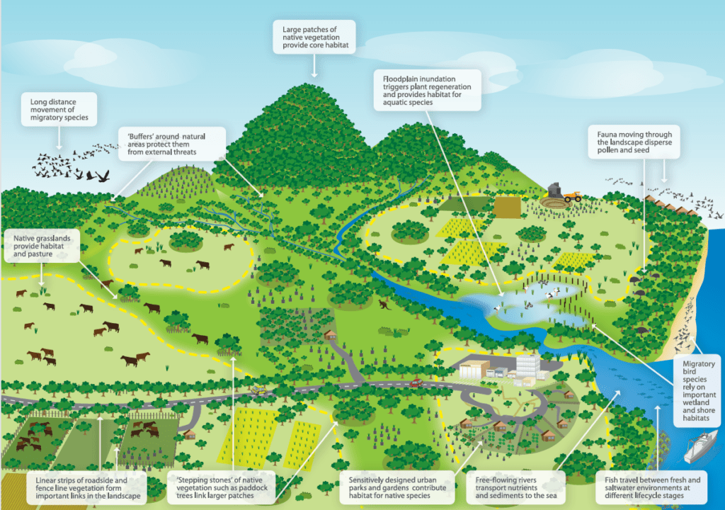
Department of Climate Change, Energy, the Environment and Water diagram showing landscape elements that contribute to wildlife corridors.
Gondwana Link project in south-western Australia.
Do biolinks actually work?
The rapid uptake of biolink projects around the world initially outpaced scientific understanding and data collection. Questions were raised about their effectiveness, particularly given the scarcity of conservation resources. Multiple studies were conducted looking at the key domains of:
Landscape connectivity – the physical connections between habitats across a landscape.
Habitat connectivity – connections between patches of habitat (‘stepping stones’) suitable for specific species.
Ecological connectivity – the function of ecosystems across space and time.
Evolutionary connectivity – allowing populations to interact naturally, breed and strengthen genetic diversity.
In 2010, the first meta-analysis was published. It showed that corridors increase migration between habitat patches by as much as 50%. Ten years later, a second analysis was done to solve questions raised in the first analysis. It found that, although not all corridors worked as planned, overall corridors effectively increase species movement, fitness and richness. This further translated into an increase in community biodiversity.
Macro (large scale) biolinks
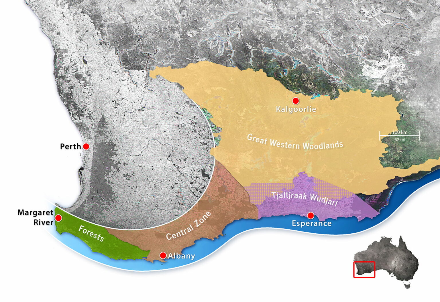
Beginning in the early 2000s, up to a dozen large-scale biolinks were proposed or established in Australia, one of the earliest being the Gondwana Link project in south-western Australia. Conceived by a small group of conservationists in 2000, the program now coordinates dozens of separate conservation projects along a 1,000 km corridor from the forests of Margaret River to the semi-arid woodlands and Mallee country bordering the Nullarbor Plain.
In 2005, Greening Australia began shaping up its Habitat 141 project; a 50-year collective response to habitat fragmentation and climate change along the 141st longitude stretching from the coast of South Australia, along the Victorian border, and up to the rugged rangelands of New South Wales.
Noting the success of these and other projects and how they might be connected to the National Reserve System (a network of more than 10,000 Commonwealth, state and territory protected areas), in 2012 the Australian Government published a National Wildlife Corridors Plan. Information on that plan is now difficult to find online. The program appears to have been folded into one of the most ambitious initiatives of all – the Great Eastern Ranges biolink.
This impressive program seeks to conserve and manage a 3,600 km ‘continental lifeline’ of habitats, landscapes and people from the Grampians in western Victoria, along the Great Divide and Eastern Escarpment of New South Wales and the Australian Capital Territory, to the wet tropics and remote Cape York Peninsula in Queensland’s far northeast.
Over 250 regional, state and national organisations have chosen to align their activities with the GER vision. Among them is the Biolinks Alliance, which performs a unique role as a capacity and partnership-building organisation consisting of 18 member Landcare networks working mostly in Central Victoria.
The missing link – community-based conservation
Australian National University researcher, Carina Wyborn, has been studying conservation connectivity since the early 2000s. Many of the themes she discusses in her publications discuss the challenges of collaboration.
“Without people working together, connectivity initiatives will go nowhere (Lovett et al. 2008), thus collaboration and community-based conservation are central.
“Centred in an ethic of place, community-based conservation is underpinned by the premise that local populations have a greater interest in and knowledge of local contexts … further, “by placing these local contributions within a larger picture (e.g large-scale programs), gives conservation on private land greater purpose.”
Paddock-scale connections
For decades, individual landholders have been working with organisations like Landcare to restore and protect pockets of habitat on private land. This work is critical, given that over 60% of all land in Australia is privately owned or managed (farms, pastoral leases and mines) and that 70% to 90% of inadequately protected wildlife is found on private land.
However, it has sometimes been difficult to see these activities within a broader vision.
Given their commitments to sustainability and better environmental management, many councils are stepping up to fill critical gaps, offering incentives to landholders and practical tools such as maps. A great example of this is Cardina Shire Council’s interactive map, which shows what has been done and what opportunities there are for improvement.
Biodiversity Legacy is also working with landholders and organisations across Australia, like Land Covenantors Victoria and Prom Coast Ecolink, to promote the connection of private landholdings and consider how they too can be tied into the vision we all share – protecting and connecting land for conservation and threatened species.
Around 10 years ago, former Melbourne schoolteacher Stuart Inchley and policymaker Victoria Johnson stumbled across a 300+ acre property for sale in the hills of South Gippsland (historically known as Land of the Lyrebird).
With a passion for conservation sustainability and climate justice, the couple made the life-changing decision to purchase the property, place a conservation covenant on it and act on its behalf as land stewards.
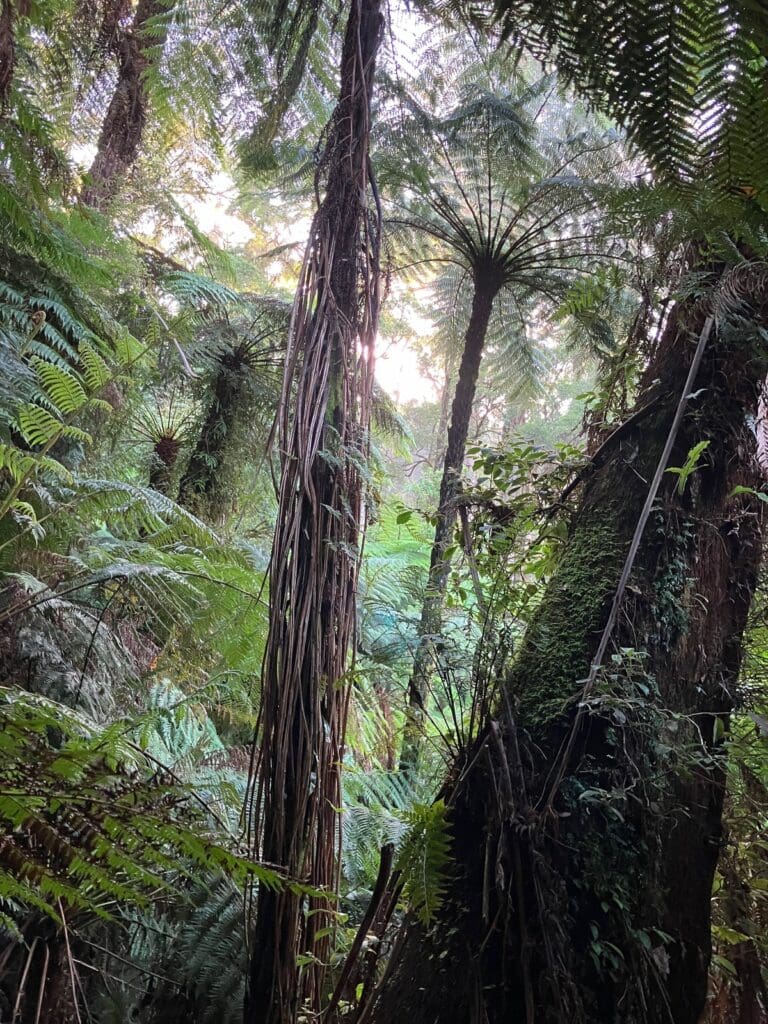
It took several years for Stuart and Victoria to properly survey the property, characterised by dense bush, cool temperate rainforest and steep terrain, learn about local species and appreciate just how unique it is.
At first, he thought there were maybe a few dozen, but with local ecologists from Gippsland Threatened Species Action Group and elsewhere, Stuart and Victoria have now counted over 260 individual plants. Given estimates suggesting that just 1,000 are left in Victoria, this is a major find that is attracting interest nationally and internationally.
Listen to leading Victorian ecologist, Karl Just, describe South Gippsland’s rainforests and species found within the Tarwin River Forest.
Back to reality
Unfortunately, Stuart and Victoria’s elation and finding so many Slender Tree-ferns was short-lived. Within just a few weeks they heard chainsaws and logging activities in the property next door.
These actions, by HPV Plantations – the largest private plantation company in Australia – came within a few metres of the couple’s fenceline; too close for comfort for the ferns, which can easily be damaged by being exposed to wind, rain and other elements.
Stuart and Victoria felt they had no choice but to launch a campaign to stop these actions, garnering huge community support through their Gippsland Forest Guardians website.
As at October 2024, Gippsland Forest Guardians, supported by Friends of the Earth, are currently embroiled in a court action relating to a Freedom of Information request, blocked by HPV, to review harvesting plans for the Turton’s Creek area.
Partnerships for protection
With Gippsland Threatened Species Action Group and other groups, Stuart and Victoria are also running campaigns to protect the last remnants of Cool Temperate Rainforest in South Gippsland, home to unique native species such as Gang-gangs, Powerful Owls, Pilotbirds, the rare and endangered Strzelecki Burrowing Crayfish and Strzelecki koala.
Typically dominated by Myrtle Beech, Southern Sassafras, Blackwood and eucalypts with a thick understorey of tree and ground ferns, these rainforests exist in high rainfall, higher altitude fertile environments. While they can still be found across Victoria, land clearing, fire and logging have reduced the amount of these forests in Victoria to a mere 0.08% of the state’s total area and are now listed as a threatened community under the Victorian Flora and Fauna Guarantee Act (1988).
In partnership with Prom Coast Ecolink and local landholders, in 2024 the Gippsland Threatened Species Action Group received a generous grant from the Wettenhall Environment Trust to undertake a mapping survey of Cool Temperate Rainforest on Stuart and Victoria’s property and three adjoining Trust for Nature properties (totalling 850 over acres) to map the distribution of Slender Tree-ferns.
We’re all behind Stuart and Victoria and the commitment they have made to protecting the environment and building connections with the local community to raise awareness of BDL and the need to strengthen local biolinks.