The excitement of conservation often centres on securing a special place. But the real reward comes afterwards - when wildlife continues to find refuge there.
That is why our team was thrilled to see footage captured by Dr Steve Enticott of Carbon Landscapes and Nooramunga Land & Sea (NL&S) showing a Southern Right Whale resting - and appearing to “wave” - in a channel beside Bullock Island.
Bullock Island is one of two neighbouring islands protected forever by NL&S through BioDiversity Legacy’s Local Landholding Entity model. Together with Little Dog Island, it safeguards 132 hectares of coastal saltmarsh in the Corner Inlet and Nooramunga wetland system.
Southern Right Whales visit Victoria’s sheltered coastal waters between May and October to rest, give birth and raise their calves. Sightings in Corner Inlet are uncommon, however, making this visitor especially exciting. An expert who viewed the footage believes it may be a young male.
The sighting is also a reminder that conservation does not stop at a property boundary.
Around 96 hectares of marine and intertidal habitat lies between the two islands. While Nooramunga Land & Sea does not own these waters, protecting the islands and their shorelines strengthens the connected channels, mudflats and coastal habitats that marine life depends on.
Seeing a Southern Right Whale resting beside Bullock Island brings that connection to life. It shows what permanent protection is ultimately for: not simply securing land, but helping create a healthier, more resilient landscape - and seascape - for nature.
Deep in the forests of East Gippsland, a major recovery project led by Gippsland-based ecological and environmental management group Wildlife Unlimited has concluded, providing essential data to inform future captive breeding, translocation and climate adaptation strategies.
BioDiversity Legacy was an early proponent of the project, supporting a successful application to the Victorian Government’s Nature Fund in 2025, enabling Wildlife Unlimited to deliver the work in partnership with a range of collaborators. Also supported by the Rendere Environmental Trust, the program reflects the practical, enabling role needed to move from conservation concern to long-term recovery action.
A decade-long pathway for recovery
Once widespread across Victoria, the Spot-tailed Quoll is now listed as Endangered under the Environment Protection and Biodiversity Conservation Act. The Upper Snowy River region of Gippsland remains one of the species’ last important strongholds in the state, but even here, populations continue to decline.
The project brought together scientists, government agencies, conservation organisations and Traditional Owners to gather the evidence needed to guide future recovery work.
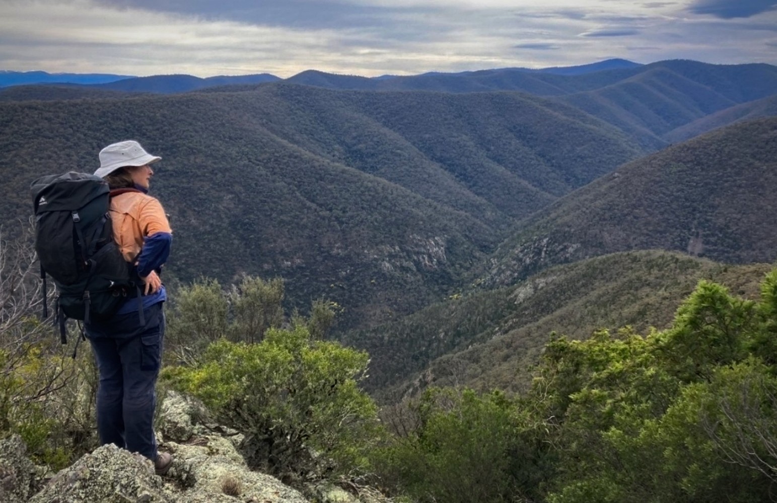
Over the course of the program, members of the Wildlife Unlimited team hiked for hours into remote areas of the East Gippsland wilderness on multiple field trips to monitor quoll activity and collect genetic samples from communal latrine sites for population analysis.
Using 4G-enabled cameras, the team captured real-time images of quoll movements during the breeding season (pictured left: Wildlife Unlimited's Willow Bourke on location).
“We were able to determine where Spot-tailed Quolls remain active in the landscape and where patterns of decline continue,” explained Wildlife Unlimited’s Rachael Bartlett.
“Scat from active sites was collected for genetic analysis, increasing our understanding of the declining southern edge of the species’ mainland range. They are mysterious and elusive animals, and core baseline monitoring is essential to support further targeted surveys and recovery action.”
The data gathered has already informed three key areas of future recovery work:
a Translocation Strategy led by Wildlife Unlimited
climate suitability modelling by Cesar Australia to better understand where Spot-tailed Quolls may persist under future climate scenarios.
The work is already building momentum. In July, Wildlife Unlimited received a Bank Australia Community Customer grant to continue monitoring quoll sites using solar-powered cellular cameras in three remote locations.
Subject to further funding, the broader project can now move towards implementing the strategies and recovery actions developed through the program.
While the project has focused on East Gippsland, its significance extends beyond the region. Collaboration with partners in southern New South Wales is helping build a clearer picture of the quoll population spanning the Victorian–NSW border. Recent and historical sightings in northern Gippsland are also important, particularly as the species’ range has contracted from across much of Victoria to a population now largely confined to Gippsland.
The project’s conclusion marks an important step in the long-term effort to protect and rebuild Spot-tailed Quoll populations. With stronger data, clearer strategies and committed partners in place, future recovery work can now be guided by a more robust evidence base, greater regional collaboration and a shared sense of urgency.
Landholders and nature lovers across South Gippsland are helping shape a regional biolink map designed to strengthen wildlife corridors and protect native and threatened species.
Being developed by the South Gippsland Landcare Network (SGLN), the map will provide a bird’s-eye view of the habitat patches, stepping stones and links that need to be protected, restored or reconnected across the landscape.
The project is a key action from SGLN’s 10-year Biodiversity Protection Plan, developed in 2024 with input from across the conservation sector, including our friends and colleagues at Prom Coast Ecolink.
The need for coordinated action is increasingly urgent. Stretching across 262,000 hectares, from the steep Strzelecki Ranges to the lowland coast, South Gippsland retains just 22% of its native vegetation, while 10% of its native species are now threatened.
After securing funding for two key phases of the project, SGLN appointed mapping specialists to gather baseline data. Through the Habitat Near You website, landholders and community members were invited to identify habitat hotspots, sightings of key species and other areas of ecological importance.
This initial phase ran from May to June 2025, with further community consultation continuing in 2026.
BioDiversity Legacy’s South Gippsland Biolink Coordinator and local community member, Stuart Inchley, contributed to the project. He welcomes SGLN’s commitment to involving landholders and communities in decisions about protecting land and reconnecting landscapes through a community-led, tenure-blind approach.
Once completed, the map will provide a strong evidence base for regional planning, help guide future conservation priorities and support greater investment in the natural values of the South Gippsland landscape.